 Hot and humid weather returns today, and will remain over the region through Tuesday.
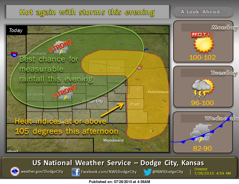
Heat indices of at or above 105 degrees will be possible across portions of central Kansas this afternoon with a high temperature of around 100. Scattered thunderstorms are anticipated to develop and move into north and west central Kansas this evening.
**A heat Advisory is in Effect from 1pm to 8pm today for Ellis County**
A cool air mass will overtake the region Wednesday, which will provide a break from the heat and humidity. Temperatures will turn cooler, with highs in the lower to middle 80s.
Today: A 20 percent chance of showers and thunderstorms after 4pm. Some of the storms could produce gusty winds, heavy rain, and frequent lightning. Sunny and hot, with a high near 100. Heat index values as high as 106.
Tonight: Showers and thunderstorms likely, mainly between 11pm and 2am. Some of the storms could produce gusty winds, heavy rain, and frequent lightning. Partly cloudy, with a low around 73. South wind 9 to 14 mph. Chance of precipitation is 60%.
Monday: A 10 percent chance of showers and thunderstorms before 7am. Mostly sunny and hot, with a high near 103. Breezy, with a south wind 9 to 14 mph increasing to 16 to 21 mph in the afternoon.
Monday Night: Partly cloudy, with a low around 75. Breezy, with a south wind 16 to 21 mph.
Tuesday: A 30 percent chance of showers and thunderstorms, mainly after 11am. Mostly sunny and hot, with a high near 100. South wind around 17 mph.