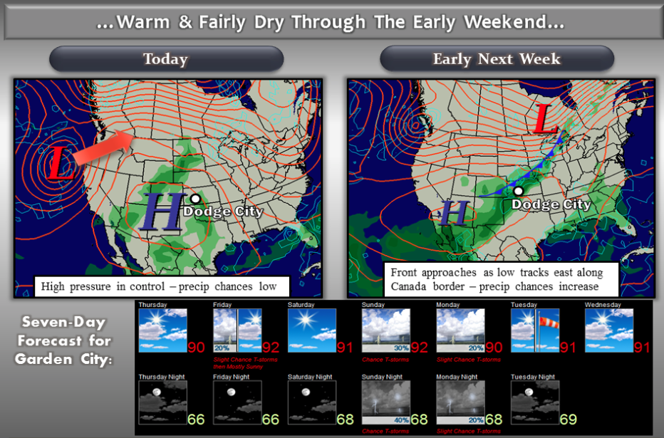
A large area of high pressure in the upper atmosphere will continue to influence our weather across western Kansas with hot and fairly dry conditions through the weekend. By late weekend into early next week, we will see our weather change as a cold front approaches. Precipitation chances will be on the increase Sunday Night into Monday as the front pushes through and interacts with some monsoon moisture from the southwest.
TodayMostly sunny, with a high near 90. South wind 6 to 14 mph.
 TonightA 10 percent chance of showers and thunderstorms after 5am. Partly cloudy, with a low around 67. South wind 6 to 13 mph.
FridayA 20 percent chance of showers and thunderstorms before 8am. Mostly sunny, with a high near 93. South wind 5 to 11 mph.
Friday NightMostly clear, with a low around 68. South southeast wind 9 to 11 mph.
SaturdaySunny, with a high near 94. South wind 9 to 14 mph.
Saturday NightMostly clear, with a low around 69.
SundayA 20 percent chance of showers and thunderstorms. Mostly sunny, with a high near 94.
Sunday NightA 30 percent chance of showers and thunderstorms. Mostly cloudy, with a low around 69.
MondayA 20 percent chance of showers and thunderstorms. Mostly sunny, with a high near 91.