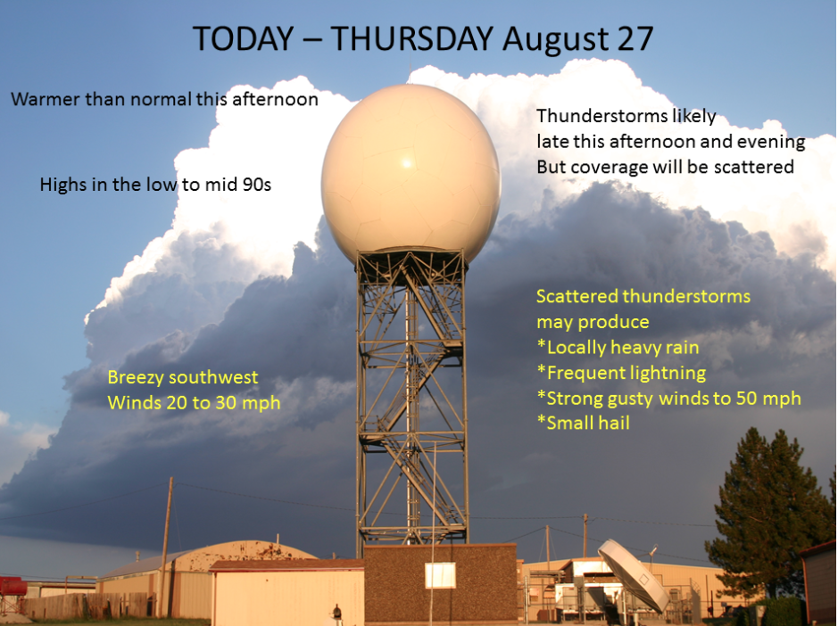
Warm temperatures return this afternoon on breezy southwest winds of 20 to 30 mph. Highs are forecast to reach the mid 90s. By late in the afternoon, clouds will be increasing as a surface cold front moves through northwest Kansas and into central Kansas by the early evening. The location of the surface front will be the focus area for scattered thunderstorms development, probably somewhere south of I-70 near Hays southwest to around Hugoton. Some of the storms may initially become strong enough to produce small hail and wind gusts around 50 mph. Although an isolated severe storm with larger hail and stronger wind is possible, widespread severe weather is not expected. Any storms that do develop will move southward into central Kansas, diminishing after midnight. Slightly cooler highs in the upper 80s are expected Friday before a gradual warming trend into the 90s resumes this weekend.
 Today A 40 percent chance of showers and thunderstorms, mainly after 3pm. Partly sunny, with a high near 96. South southwest wind 7 to 12 mph increasing to 13 to 18 mph in the afternoon. Winds could gust as high as 28 mph.
Tonight Showers and thunderstorms likely, mainly before 9pm. Mostly cloudy, with a low around 65. South southwest wind 10 to 18 mph. Chance of precipitation is 60%. New rainfall amounts between a quarter and half of an inch possible.
FridayMostly sunny, with a high near 88. West wind 10 to 13 mph becoming north in the afternoon.
Friday NightMostly clear, with a low around 62. North wind 5 to 11 mph.
SaturdaySunny, with a high near 89. North northeast wind 6 to 8 mph becoming east in the afternoon.
Saturday NightMostly clear, with a low around 62.
SundaySunny, with a high near 93.
 Today A 40 percent chance of showers and thunderstorms, mainly after 3pm. Partly sunny, with a high near 96. South southwest wind 7 to 12 mph increasing to 13 to 18 mph in the afternoon. Winds could gust as high as 28 mph.