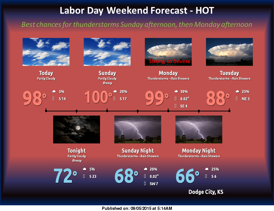
 The Labor Day Weekend will be warmer than normal for this time of year. Hot temperatures are expected Today and Sunday with highs around 100.
A cold front will stall out across southwest Kansas on Sunday into Monday Night, bringing a slight chance for thunderstorms, mainly in the late afternoon and evening. Tuesday will be slightly cooler behind a cold front with highs in the upper 80s.
Today: Mostly sunny and hot, with a high near 100. Breezy, with a south wind 11 to 16 mph increasing to 17 to 22 mph in the afternoon.
Tonight: Partly cloudy, with a low around 74. South wind 14 to 18 mph, with gusts as high as 28 mph.
Sunday: Mostly sunny and hot, with a high near 100. South wind 14 to 17 mph.
Sunday Night: A 20 percent chance of showers and thunderstorms. Partly cloudy, with a low around 67. North wind 5 to 10 mph becoming light and variable after midnight.
Labor Day: A 30 percent chance of showers and thunderstorms, mainly after 11am. Partly sunny, with a high near 93. Northeast wind 5 to 13 mph.