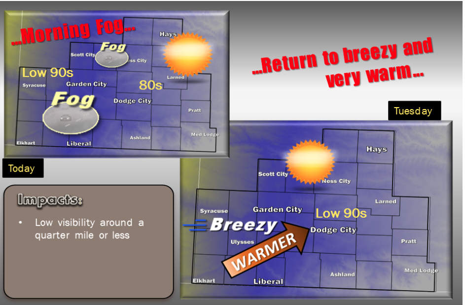
Dense fog will likely expand across sections of west central and southwest Kansas on Monday morning. Locations from Ulysses to Garden City, Scott City and Ness City may be the most favored areas for dense fog. If the fog expands across a large enough area, it could linger through the mid to late morning hours. Temperatures today will be influenced by lingering low level clouds over central Kansas. As a result, highs in the more sunny west should easily reach the 90s, while farther east, only the low 80s. Lows tonight will once again be mild, in the mid 60s, however fog will not be as likely. By Tuesday, breezy winds and full sun will return with warm low 90s overspreading the entire area. Temperatures will be slightly cooler by Wednesday and into Thursday as a subtropical jet arrives bringing increased clouds followed chances for widespread showers and scattered thunderstorms to the Central Plains.
 Today Areas of fog before 8am. Otherwise, cloudy through mid morning, then gradual clearing, with a high near 82. South wind 6 to 14 mph.
Tonight Mostly clear, with a low around 63. South southeast wind 7 to 13 mph.
Tuesday Sunny, with a high near 92. South wind 10 to 17 mph.
Tuesday NightA 20 percent chance of showers and thunderstorms after 3am. Partly cloudy, with a low around 66. South wind 11 to 17 mph.
WednesdayA 40 percent chance of showers and thunderstorms, mainly after 7am. Mostly cloudy, with a high near 86. Breezy, with a south wind 14 to 22 mph.
Wednesday NightA 50 percent chance of showers and thunderstorms. Mostly cloudy, with a low around 63. Breezy.
ThursdayA 40 percent chance of showers and thunderstorms. Partly sunny, with a high near 82.
Thursday NightA 40 percent chance of showers and thunderstorms. Mostly cloudy, with a low around 60.
FridayMostly sunny, with a high near 81.