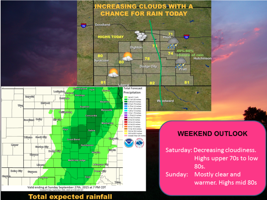
Cloudiness will increase in central and northern Kansas this morning and across much of western Kansas tonight as an upper level low moves from Nebraska into northern Kansas. Showers and a few thunderstorms will develop in central Kansas by early afternoon and spread into southern Kansas by evening.
 Today A chance of showers and thunderstorms, then showers likely and possibly a thunderstorm after 4pm. Patchy fog before 10am. Otherwise, mostly cloudy, with a high near 72. Northwest wind 6 to 9 mph. Chance of precipitation is 60%. New rainfall amounts of less than a tenth of an inch, except higher amounts possible in thunderstorms.
Tonight A 40 percent chance of showers and thunderstorms, mainly before 11pm. Patchy fog after 4am. Otherwise, mostly cloudy, with a low around 57. Northeast wind 5 to 9 mph.
SaturdayPatchy fog before 9am. Otherwise, mostly sunny, with a high near 82. Northeast wind 5 to 10 mph becoming east southeast in the afternoon.
Saturday NightMostly clear, with a low around 56. East southeast wind 6 to 9 mph.
SundaySunny, with a high near 87. South wind 7 to 14 mph.
Sunday NightMostly clear, with a low around 61.
MondaySunny, with a high near 88.