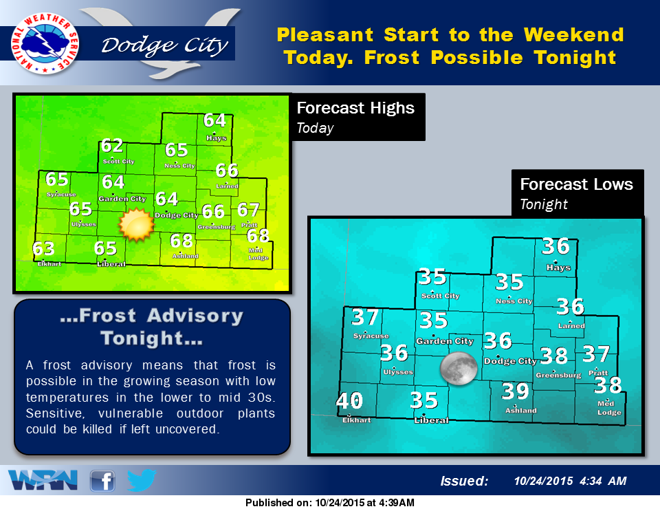
 Cool high pressure will settle in across western Kansas to start the weekend. Light winds are forecast today as the center of the high will be positioned across west central Kansas. Highs will reach the lower to mid 60s.
Tonight, clear skies and light winds will allow temperatures to bottom out in the mid 30s. Some frost will likely develop, especially in low lying areas. A frost advisory is in effect for early Sunday morning.
Looking ahead into next week, clouds will increase Monday as low pressure develops over the Northern Plains. The associated cold front will move through Tuesday night. A few showers or some sprinkles will be possible mainly Tuesday into Tuesday night. Wednesday through Friday will be cooler with highs in the upper 50s.
Today: Sunny, with a high near 64. Northwest wind 7 to 14 mph.
Tonight: Areas of frost after 1am. Otherwise, clear, with a low around 36. East northeast wind around 6 mph becoming south after midnight.
Sunday: Areas of frost before 9am. Otherwise, sunny, with a high near 67. South wind 6 to 11 mph.
Sunday Night: Mostly clear, with a low around 38. South wind 6 to 9 mph.
Monday: Mostly sunny, with a high near 66. South southeast wind 7 to 12 mph increasing to 13 to 18 mph in the afternoon. Winds could gust as high as 28 mph