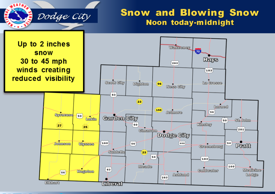
Strong winds in the 30 to 45 mph range will develop over western Kansas this morning. In addition, a broken band of light snow will move eastward out of eastern Colorado as early as around noon. Precipitation could begin as rain before changing over to snow. Snow amounts are expected to be relatively minor, however in combination with the winds, may produce a period of hazardous travel conditions by reducing visibility in blowing snow an making roads slick. Areas affected the greatest will be generally west of Lakin, to Syracuse and along the Kansas-Colorado line. Mid afternoon through early evening is the period of the most likely deteriorating travel conditions.
 Today A 50 percent chance of rain. Partly sunny, with a temperature falling to around 45 by 5pm. East northeast wind 9 to 13 mph becoming northwest in the afternoon.
Tonight A 50 percent chance of snow, mainly before 3am. Mostly cloudy, with a low around 32. Breezy, with a northwest wind 11 to 16 mph increasing to 17 to 22 mph after midnight. Little or no snow accumulation expected.
WednesdayMostly sunny, with a high near 57. West wind 14 to 17 mph.
Wednesday NightPartly cloudy, with a low around 28. North northwest wind 7 to 15 mph.
ThursdayMostly sunny, with a high near 51.
Thursday NightPartly cloudy, with a low around 30.
FridayMostly sunny, with a high near 52.
Friday NightPartly cloudy, with a low around 27.
SaturdayMostly sunny, with a high near 41.