 Expect a chilly weekend ahead as freezing drizzle is forecast across the region throughout the weekend, although no additional accumulations are expected.
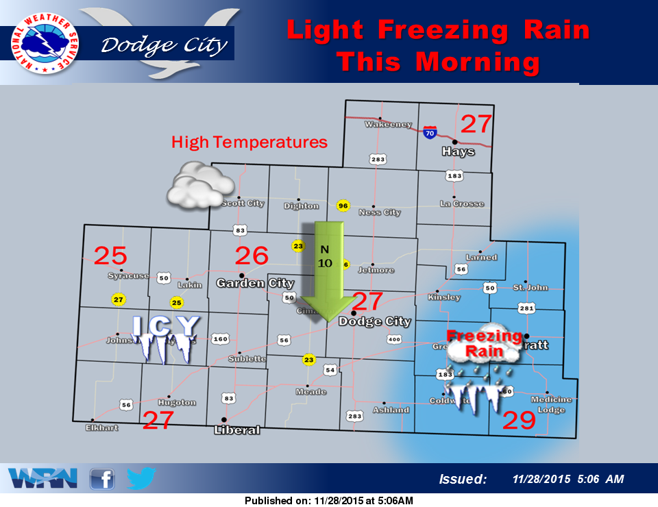
High temperatures today will remain in the mid 20s and only climb to near 30 degrees on Sunday. There is a chance of light freezing rain through the morning hours in south central Kansas. Roads may be slick across much of southwestern Kansas due to previous precipitation and continued cold temperatures.
The next winter weather system will move through the area Sunday night through Monday night and will bring a decent chance for snow in the central plains. Stay up to date on the latest forecast with Eagle Radio and Hayspost.
Saturday: A chance of patchy freezing drizzle and sleet between 8am and 4pm, then patchy freezing drizzle after 4pm. Cloudy, with a high near 28. North northeast wind 8 to 10 mph. Chance of precipitation is 30%.
Saturday Night: Patchy freezing drizzle before 11pm, then Cloudy, with a low around 20. North northeast wind around 7 mph. Chance of precipitation is 20%.
Sunday: A chance of snow before 5pm, then a chance of snow and sleet. Cloudy, with a high near 30. North northeast wind around 8 mph. Chance of precipitation is 50%. New snow and sleet accumulation of less than a half inch possible.
Sunday Night: Snow and sleet likely before midnight, then snow. Low around 26. East northeast wind 6 to 8 mph. Chance of precipitation is 80%. New precipitation amounts between a quarter and half of an inch possible.
Monday: A chance of snow, possibly mixing with rain after 1pm, then gradually ending. Mostly cloudy, with a high near 33. Chance of precipitation is 50%.