 Saturday will be cold and windy across the area. There are slight chances of sleet and flurries from the early to late afternoon. Winds will be 20 to 30 mph from the NW shifting to the north during the day, with a slight decrease to 15 to 25 mph from the north overnight.
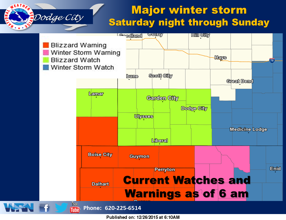
A major winter storm will impact southwest and south central Kansas late this weekend. Blizzard and Winter Storm Watches and Warnings have been issued given the expected snowfall along with the strong gusty winds. If traveling late this weekend be prepared by planning ahead. Have a winter safety kit and check on the latest road conditions. Stay up to date on this weekend weather event at Eagle Radio and Hayspost.
Today: A slight chance of sleet between noon and 5pm, then a chance of snow. Cloudy, with a high near 34. Very windy, with a north northwest wind 8 to 18 mph increasing to 21 to 31 mph in the afternoon. Chance of precipitation is 30%.
Tonight: A 40 percent chance of snow, mainly before 2am. Cloudy, with a low around 17. Wind chill values as low as 1. Blustery, with a north wind 22 to 24 mph.
Sunday: A 30 percent chance of snow, mainly after 4pm. Cloudy, with a high near 26. Wind chill values as low as -1. Windy, with a north wind 21 to 26 mph, with gusts as high as 36 mph.
Sunday Night: Snow likely, mainly after 2am. Cloudy, with a low around 18. Wind chill values as low as 1. Windy, with a north wind 18 to 26 mph, with gusts as high as 36 mph. Chance of precipitation is 60%. New snow accumulation of 1 to 3 inches possible.
Monday: Snow likely, mainly before 1pm. Mostly cloudy, with a high near 24. Blustery, with a north wind 14 to 23 mph. Chance of precipitation is 60%.