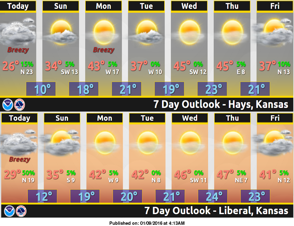
 Scattered flurries early this morning, then cold temperatures are forecast through the weekend as cold Canadian air moves into the region.
High temperatures for Saturday are expected to be in the mid 20s. The winds will be northerly at 15 to 25 mph. Sunday morning will start off cold with low temperatures near 8-10 degrees. Sunday afternoon will be a little warmer with high temperatures around 35.
Temperatures will then moderate to near normal by early next week. With a warming trend continuing into Thursday.
Saturday: Periods of flurries before 8am. High near 28. North wind 14 to 17 mph.
Saturday Night: Partly cloudy, with a low around 8. Wind chill values as low as -1. North wind 5 to 13 mph.
Sunday: Mostly sunny, with a high near 36. Wind chill values as low as 1. Light and variable wind becoming south southwest 6 to 11 mph in the morning.
Sunday Night: Mostly clear, with a low around 20. South southwest wind 8 to 10 mph.
Monday: Mostly sunny, with a high near 45.