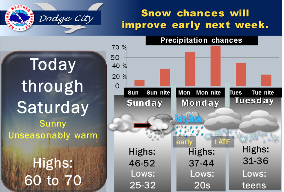
A cold front Saturday night will bring the next shot of colder air to western Kansas. There will also be a chance for snow from Sunday night through late Tuesday. At this time it appears that the best chance for measurable snowfall will be Monday and Monday night with significant snow accumulations possible across portions of western Kansas. Given the uncertainty of the track of this next winter storm system it is still too early to tell how much snow will fall in western Kansas.
 Today Sunny, with a high near 60. West northwest wind 5 to 14 mph becoming south southwest in the afternoon.
Tonight Mostly clear, with a low around 29. South southwest wind 3 to 6 mph.
FridaySunny, with a high near 63. Light and variable wind becoming north northwest 5 to 10 mph in the afternoon.
Friday NightPartly cloudy, with a low around 30. North northwest wind 5 to 9 mph becoming light and variable after midnight.
SaturdayMostly sunny, with a high near 60. Light and variable wind becoming south southeast 8 to 13 mph in the morning.
Saturday NightMostly cloudy, with a low around 31.
SundayPartly sunny, with a high near 46.
Sunday NightA 20 percent chance of snow. Mostly cloudy, with a low around 29.
MondayA 50 percent chance of snow. Cloudy, with a high near 37.