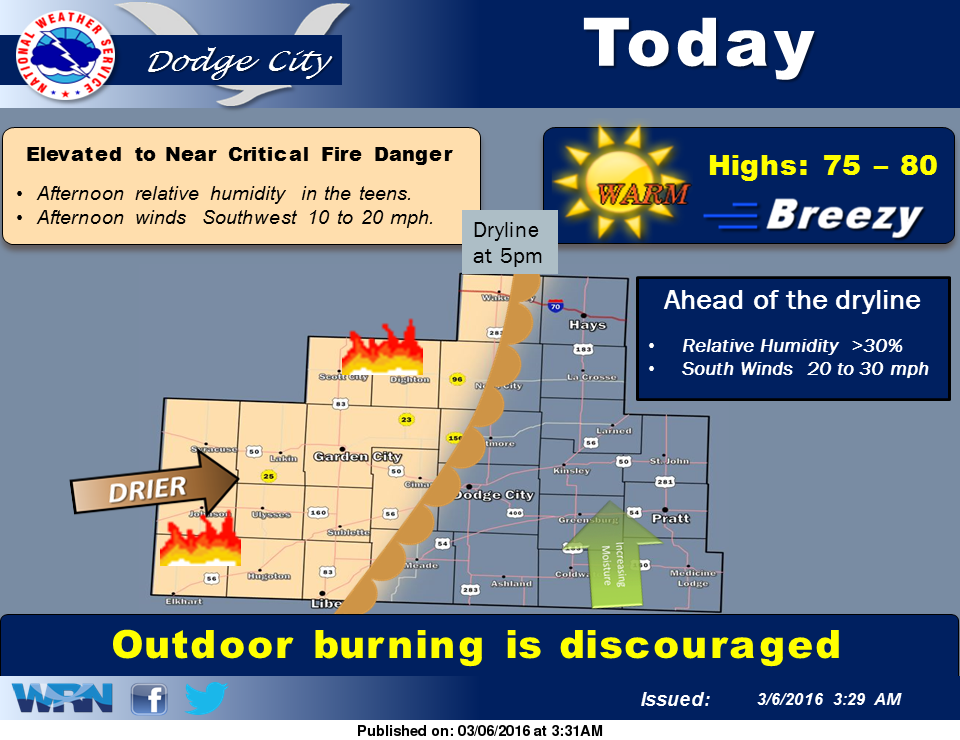
 Today will be windy and warm, with high temperatures between 75 and 80. A dryline will move across western Kansas today. West of this dryline, elevated to near critical fire danger levels are expected Outdoor burning is discouraged this afternoon.
Monday is expected to be similar to today, except a little warmer, with record, or near record highs in the 80s. Temperatures will turn cooler Tuesday and Wednesday, but remain warmer than normal for early March. Temperatures are then expected to be warmer again on Thursday and Friday.
Today: Mostly sunny, with a high near 77. Breezy, with a south wind 15 to 23 mph.
Tonight: Partly cloudy, with a low around 53. South wind 9 to 16 mph.
Monday: Sunny, with a high near 81. Very windy, with a south southwest wind 14 to 24 mph increasing to 24 to 34 mph in the afternoon. Winds could gust as high as 45 mph.
Monday Night: Mostly clear, with a low around 43. Breezy, with a south wind 14 to 24 mph becoming west northwest after midnight.
Tuesday: Mostly sunny, with a high near 63. West northwest wind 11 to 15 mph becoming north northeast in the afternoon.