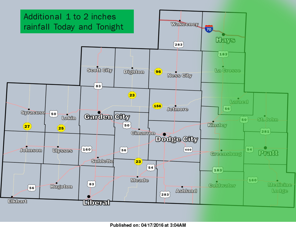
 Rain and isolated thunderstorms will likely be ongoing to start Sunday morning as well as later in the day. Even if the rainfall stops as the morning progresses, additional rounds of moderate rainfall will resume by mid afternoon. Be alert to rising water in flooded ditches, creeks and low lying areas along rural roads through tonight. A Flood Watch remains in effect until Monday morning (Hays-LaCrosse-Larned-Kinsley-Coldwater-St. John-Pratt-Medicine Lodge).
By Monday afternoon, three-day rain totals of generally 3 to 6 inches will be common across the area. Following a brief break from rainfall Monday afternoon into Monday night, additional chances for showers and isolated thunderstorms return for Tuesday through Thursday.
Today: Showers and possibly a thunderstorm. High near 54. North northwest wind 9 to 14 mph. Chance of precipitation is 100%. New rainfall amounts between 1 and 2 inches possible.
Tonight: Showers and possibly a thunderstorm before 8pm, then showers and thunderstorms likely, mainly between 8pm and 4am. Low around 43. North northwest wind around 17 mph. Chance of precipitation is 80%. New rainfall amounts between a half and three quarters of an inch possible.
Monday: A 20 percent chance of showers and thunderstorms before 10am. Mostly cloudy, with a high near 63. Northwest wind 14 to 18 mph, with gusts as high as 28 mph.
Monday Night: Partly cloudy, with a low around 42. Northwest wind 6 to 11 mph.
Tuesday: A chance of showers, with thunderstorms also possible after 1pm. Partly sunny, with a high near 64. North wind 7 to 9 mph becoming southeast in the afternoon. Chance of precipitation is 50%.