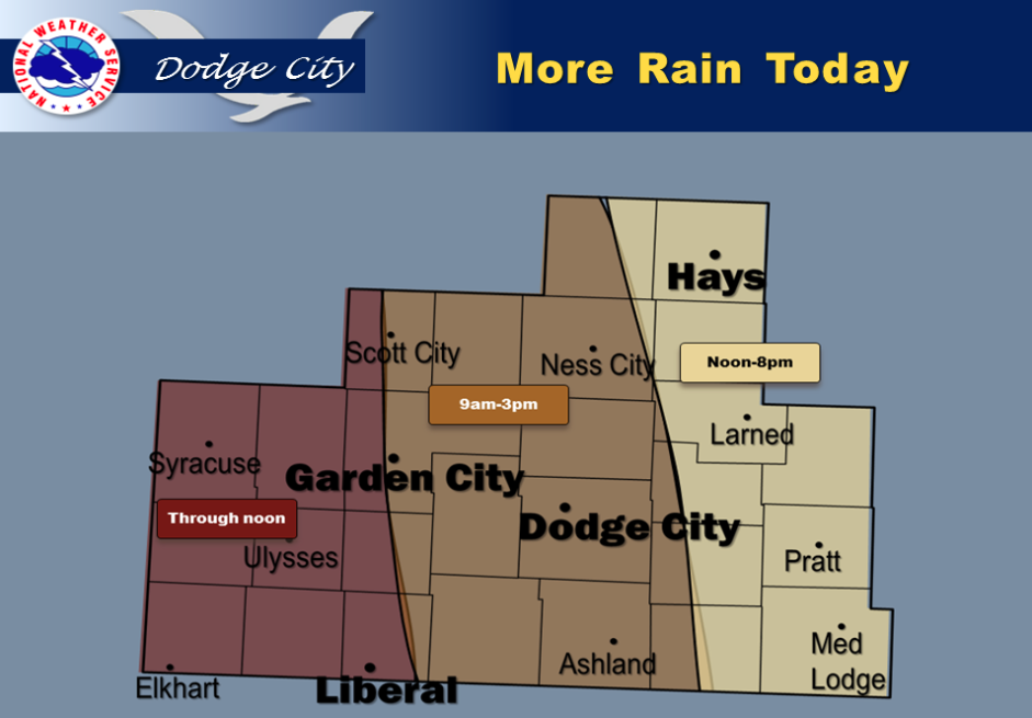
Rain showers and isolated thunderstorms will spread into the southwest, reaching the Scott City-Garden City-Liberal areas by 6 or 7 am. The bands of rain and rain showers then will continue to spread eastward through the late morning hours and early afternoon.
Rain will be continuing all afternoon in the east (Wakeeney-Hays-LaCrosse-Saint John-Coldwater-Medicine Lodge).
By mid to late afternoon the rain will probably have ended in the far west near the Colorado line. Rainfall amounts will be on the order of one quarter of an inch in most areas to as much as three quarters of an inch.
Minor showers may continue all evening following the rain, however these timeframes represent the periods of expected heaviest rainfall.
 Today Showers and thunderstorms likely, then showers and possibly a thunderstorm after 4pm. High near 55. North northwest wind 5 to 8 mph becoming east northeast in the morning. Chance of precipitation is 80%. New rainfall amounts between a tenth and quarter of an inch, except higher amounts possible in thunderstorms.
Tonight Showers and thunderstorms likely, mainly before 10pm. Cloudy, with a low around 41. North wind 5 to 8 mph. Chance of precipitation is 60%. New rainfall amounts between a tenth and quarter of an inch, except higher amounts possible in thunderstorms.
WednesdayA chance of showers and thunderstorms before 3pm, then a slight chance of showers after 5pm. Mostly cloudy, with a high near 65.
West northwest wind 6 to 10 mph. Chance of precipitation is 30%.
Wednesday NightA 30 percent chance of showers and thunderstorms, mainly before 8pm. Mostly cloudy, with a low around 42. Northwest wind 7 to 10 mph.
ThursdayMostly sunny, with a high near 71. North northwest wind 8 to 14 mph.
Thursday NightMostly clear, with a low around 43.
FridaySunny, with a high near 75.