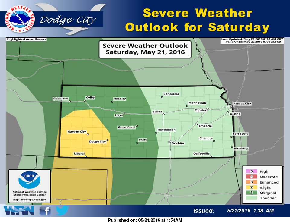
 A few showers and thunderstorms are possible this morning in central and south central Kansas. A few severe thunderstorms may develop late this afternoon along a warm front from east central Colorado into northwest Oklahoma and a dryline near the Colorado border. The primary threat will be large hail and damaging winds, but a tornado is possible in west central Kansas around sunset.
On Sunday, thunderstorms will likely develop across western parts of Kansas in the afternoon and early evening. These storms will continue overnight into Monday morning.
Today: A slight chance of showers and thunderstorms before 2pm, then a chance of showers and thunderstorms after 5pm. Patchy fog before 7am. Otherwise, cloudy, with a high near 65. Southeast wind 11 to 18 mph, with gusts as high as 28 mph. Chance of precipitation is 30%.
Tonight: A 30 percent chance of showers and thunderstorms, mainly between 11pm and 5am. Cloudy, with a low around 61. Southeast wind 13 to 15 mph.
Sunday: A 30 percent chance of showers and thunderstorms, mainly after 7am. Partly sunny, with a high near 80. Windy, with a south wind 14 to 19 mph increasing to 20 to 25 mph in the afternoon.
Sunday Night: A 50 percent chance of showers and thunderstorms. Mostly cloudy, with a low around 64. Breezy, with a south southeast wind 15 to 24 mph.
Monday: A 30 percent chance of showers and thunderstorms. Mostly sunny, with a high near 83. West wind 7 to 13 mph becoming south in the afternoon.