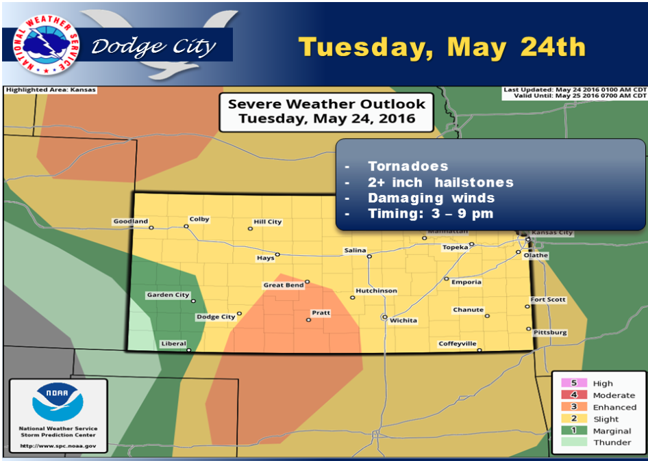
Severe thunderstorm development is likely again by mid afternoon and ending by the early evening. Tornadoes, large hail and damaging wind are all potential hazards this afternoon. The focus area of highest probability for tornadoes and hail in excess of 2 inches will be roughly from Meade to Dodge City to Larned and eastward into central Kansas. A general severe weather threat also covers most of our area late this afternoon, with the exception of the area around Elkhart.
Tuesday A chance of showers and thunderstorms before 1pm, then a slight chance of showers and thunderstorms after 4pm. Mostly cloudy, with a high near 80. Breezy, with a south southeast wind 10 to 20 mph. Chance of precipitation is 50%.
 Tuesday Night A 30 percent chance of showers and thunderstorms, mainly before 9pm. Mostly cloudy, with a low around 62. South wind 15 to 18 mph, with gusts as high as 28 mph.
Wednesday Sunny, with a high near 88. South southwest wind around 10 mph.
Wednesday NightMostly clear, with a low around 57. Southeast wind around 10 mph.
ThursdayA 30 percent chance of showers and thunderstorms, mainly after 3pm. Mostly sunny, with a high near 85.
Thursday NightA 40 percent chance of showers and thunderstorms. Partly cloudy, with a low around 58. Breezy.
FridayA 30 percent chance of showers and thunderstorms. Partly sunny, with a high near 80.