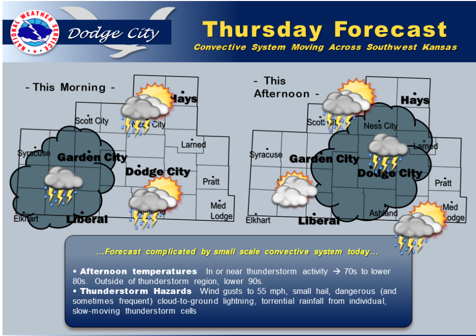
A convective storm system overnight will continue to slowly weaken by sunrise, however with just a little bit of heating by late morning, it will likely regenerate thunderstorm activity near the remnant low which will be moving slowly east across southwest Kansas. This will have an impact on temperatures today. Some areas will not see the forecast highs of lower 90s with all the convective cloud debris and regeneration of thunderstorm activity. The severe weather risk is quite low, given the very poor wind shear environment.
 Today A 40 percent chance of showers and thunderstorms, mainly after noon. Partly sunny, with a high near 90. Northeast wind 7 to 13 mph becoming east southeast in the afternoon.
Tonight Showers and thunderstorms likely, mainly between 10pm and 3am. Mostly cloudy, with a low around 70. East southeast wind 8 to 15 mph. Chance of precipitation is 60%. New rainfall amounts between a quarter and half of an inch possible.
Friday A chance of showers and thunderstorms before noon, then a slight chance of showers and thunderstorms after 2pm. Partly sunny, with a high near 95. Breezy, with a south wind 8 to 13 mph increasing to 16 to 21 mph in the afternoon. Chance of precipitation is 30%.
Friday Night A 20 percent chance of showers and thunderstorms. Partly cloudy, with a low around 72. Breezy, with a south wind 15 to 21 mph.
Saturday A 30 percent chance of showers and thunderstorms, mainly after 1pm. Mostly sunny, with a high near 96. South wind 13 to 16 mph.
Saturday Night A 30 percent chance of showers and thunderstorms. Mostly cloudy, with a low around 68.
Sunday A 20 percent chance of showers and thunderstorms. Partly sunny, with a high near 92.