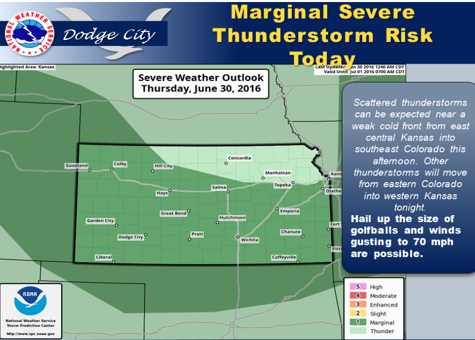
Thunderstorms can be expected to develop near a weak stationary front from eastern Kansas to the northern Texas Panhandle and near a reinforcing cold front that will move into northern Kansas this afternoon. Some of the thunderstorms will be severe and may produce hail up to the size of golfballs and winds to 60-70 mph.
 Today A slight chance of showers and thunderstorms before 10am, then a slight chance of showers and thunderstorms after 11am. Partly sunny, with a high near 86. North northeast wind 5 to 11 mph becoming east in the morning. Chance of precipitation is 20%.
Tonight Showers and thunderstorms likely, mainly after 10pm. Mostly cloudy, with a low around 64. East wind 8 to 13 mph. Chance of precipitation is 70%. New rainfall amounts between a half and three quarters of an inch possible.
FridayA 50 percent chance of showers and thunderstorms. Cloudy, with a high near 79. East wind 8 to 14 mph.
Friday NightShowers and thunderstorms likely, mainly before 1am. Cloudy, with a low around 63. East wind 10 to 14 mph. Chance of precipitation is 60%. New rainfall amounts between three quarters and one inch possible.
SaturdayShowers and thunderstorms likely, mainly after noon. Cloudy, with a high near 79. Chance of precipitation is 60%. New rainfall amounts between a quarter and half of an inch possible.
Saturday NightShowers and thunderstorms likely, mainly before 10pm. Cloudy, with a low around 64. Chance of precipitation is 60%. New rainfall amounts between a half and three quarters of an inch possible.
SundayA 30 percent chance of showers and thunderstorms. Mostly cloudy, with a high near 81.