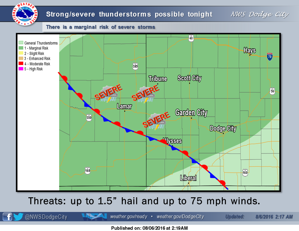
 Today there are low chances for fairly spotty, off-and-on showers and weak thunderstorms during the day. Temperatures today look to be a touch warmer than previously expected, but still only reaching the mid to upper 70s in most locations. There is a marginal risk of severe storms across western Kansas this evening and overnight.
Sunday, looks to be the coolest day of the next week, with lingering showers and thunderstorms especially during the morning hours. High temperatures Sunday will be around 80. Chances for showers and storms continue for Sunday night into Monday morning. Looking ahead into next week, off-and-on chances for thunderstorms continue, the main weather story will be a return to more summer-like temperatures.
Today: A 40 percent chance of showers and thunderstorms, mainly before 10am. Areas of fog before 10am. Otherwise, cloudy, with a high near 79. East wind 7 to 10 mph.
Tonight: Showers and thunderstorms likely, mainly between 1am and 5am. Cloudy, with a low around 66. East wind 9 to 11 mph. Chance of precipitation is 60%. New rainfall amounts between a half and three quarters of an inch possible.
Sunday: A 30 percent chance of showers and thunderstorms, mainly before 7am. Mostly cloudy, with a high near 82. East wind around 11 mph.
Sunday Night: A 30 percent chance of showers and thunderstorms. Mostly cloudy, with a low around 66. Northeast wind 7 to 13 mph.
Monday: A 20 percent chance of showers and thunderstorms before 1pm. Partly sunny, with a high near 90. East northeast wind 7 to 10 mph becoming south southeast in the afternoon.