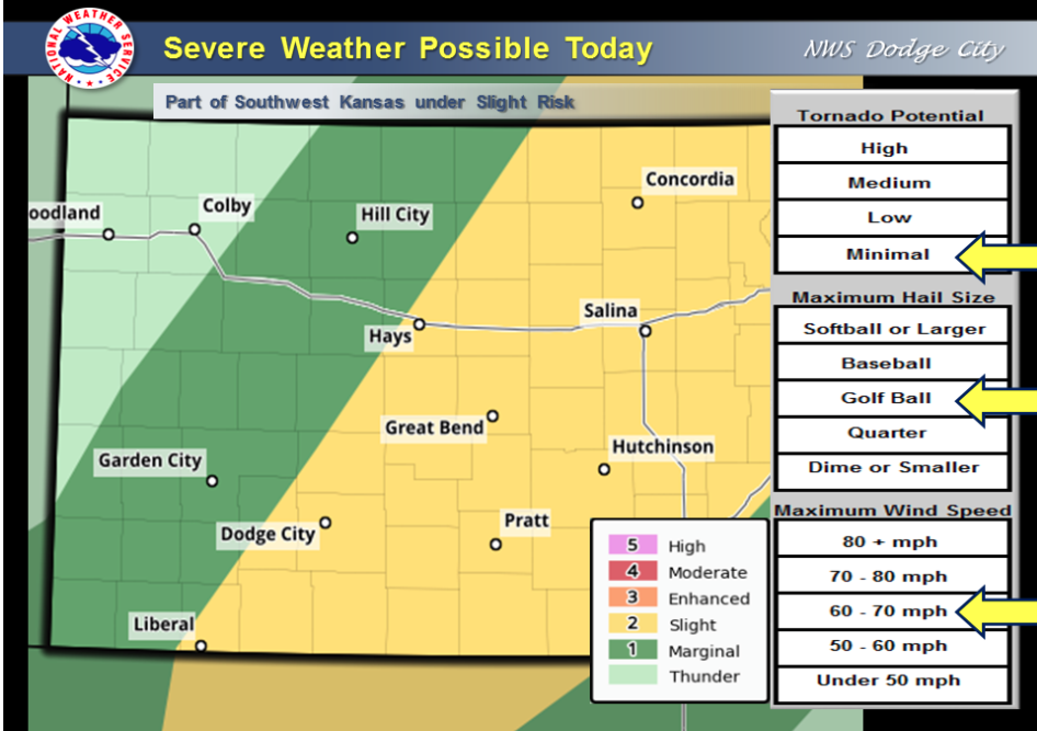
A cold front will move across western Kansas today with a chance for severe thunderstorms. The best chance for storms will be early afternoon in the Liberal to Dodge City to Hays areas, and by mid to late afternoon in the in the Ashland to Pratt areas and east. Large hail from quarter to golf ball size, and damaging winds over 60 mph.
Today Showers and thunderstorms likely, mainly between 4pm and 5pm. Partly sunny, with a high near 85. South southeast wind 7 to 11 mph. Chance of precipitation is 60%. New rainfall amounts between a quarter and half of an inch possible.
Tonight Showers and thunderstorms likely, mainly before 10pm. Mostly cloudy, with a low around 57. North northwest wind 9 to 16 mph. Chance of precipitation is 70%. New precipitation amounts between a tenth and quarter of an inch, except higher amounts possible in thunderstorms.
SaturdayMostly cloudy, then gradually becoming sunny, with a high near 76. North northwest wind 14 to 17 mph.
Saturday NightMostly clear, with a low around 53. North wind 5 to 9 mph becoming calm in the evening.
SundaySunny, with a high near 85. West southwest wind 6 to 11 mph becoming south in the afternoon.
Sunday NightMostly clear, with a low around 62.
MondaySunny, with a high near 87. Breezy.