 Most of the day will bring plenty of sun and temperatures near normal for late August. A round of thunderstorms is likely this evening, moving out of eastern Colorado and into Kansas. Heavy rain and lightning are the primary threats, although marginal severe weather conditions could occur with strong wind gusts.
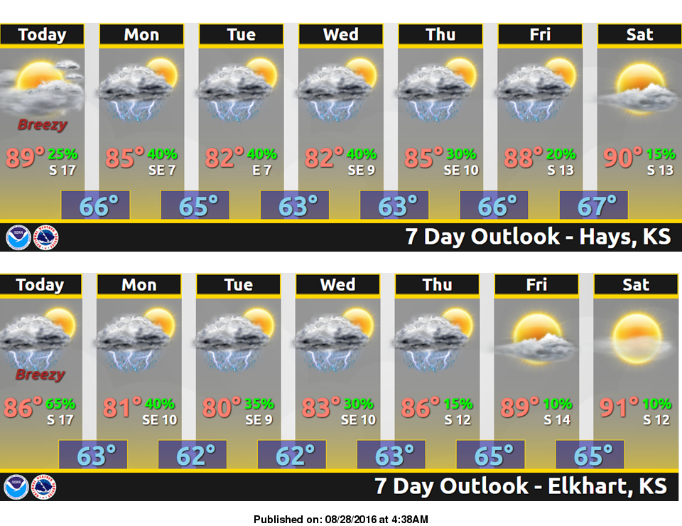
An unsettled weather pattern will bring periodic and generally small chances for precipitation to the region as we get into the new week. Partly to mostly cloudy skies are expected through the middle of the week, with winds remaining southerly. High temperatures are forecast to be in the 80s.
Today: Mostly sunny, with a high near 89. Light east southeast wind becoming south southeast 9 to 14 mph in the morning.
Tonight: A 30 percent chance of showers and thunderstorms, mainly after 3am. Mostly cloudy, with a low around 66. South southeast wind 6 to 13 mph.
Monday: A 30 percent chance of showers and thunderstorms. Mostly cloudy, with a high near 85. South southeast wind 6 to 8 mph.
Monday Night: A 40 percent chance of showers and thunderstorms. Mostly cloudy, with a low around 65. East southeast wind 3 to 7 mph.
Tuesday: A 40 percent chance of showers and thunderstorms. Mostly cloudy, with a high near 82. Light and variable wind becoming southeast around 6 mph in the morning.