 A cool front will slowly cross the region today, resulting in a few showers, and possibly some rumbles of thunder. Any showers or storms will quickly clear out early this evening. A high pressure system over the western United States will build into the region Sunday and Monday and several days of dry weather are expected. Then it will depart into the eastern United States Tuesday and remain there for the rest of the week. Temperatures will turn cooler Sunday and Monday. Temperatures will warm back to near normal Tuesday and remain there for the rest of the week.
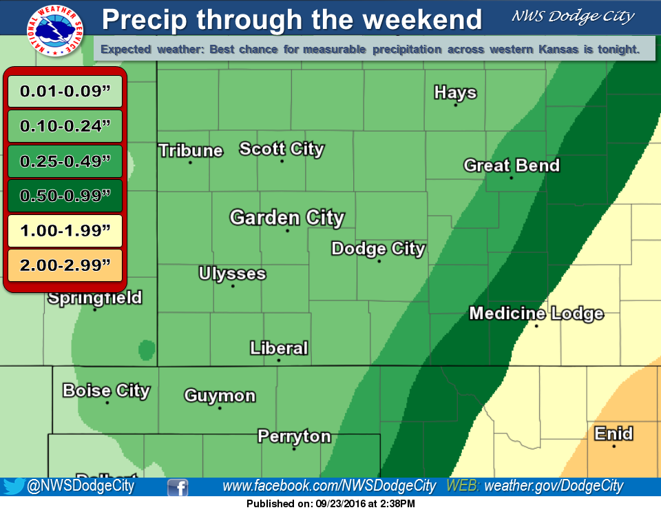
Today: A 40 percent chance of showers and thunderstorms, mainly between 10am and 11am. Partly sunny, with a high near 81. Southwest wind 7 to 10 mph.
Tonight: A 30 percent chance of showers and thunderstorms, mainly before 11pm. Partly cloudy, with a low around 54. Light and variable wind becoming north northwest 6 to 11 mph after midnight.
Sunday: Mostly sunny, with a high near 73. North wind 13 to 17 mph.
Sunday Night: Mostly clear, with a low around 45. North northwest wind 6 to 9 mph.
Monday: Sunny, with a high near 73. North northwest wind 7 to 9 mph.