 Forecasters are warning motorists that the anticipated snowstorm expected to hit after midnight could cause limited visibility.
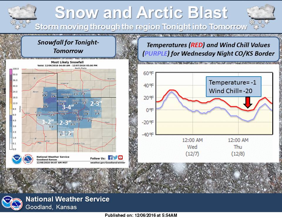
According to the National Weather Service, snow from the fast-moving front, which is moving west to east, is expected to be accompanied by 25-30 mph wind gusts. The area most likely to be impacted is the northwest corner of the state.
The temperature will take a dramatic dip, as well, with overnight wind chills expected to be as low as 20 below zero in northwest Kansas counties.
The snow is expected to continue into Wednesday morning, with winds tapering off as the day progresses.
Snowfall totals are expected to be 2 to 4 inches north and west of Hays.
In Hays, snowfall totals are expected to be around an inch.
The dangerously cold temperature is expected to last into the weekend, with overnight lows in the single digits Wednesday and Thursday.