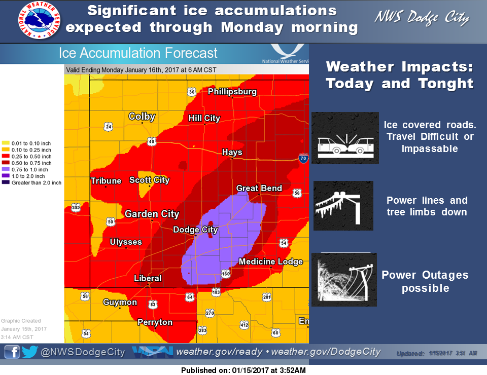
 An ice storm warning remains in effect for the area until Monday morning at 6am
Today
Freezing rain, possibly mixed with sleet, becoming all freezing rain after 5pm. High near 32. East wind 3 to 6 mph. Chance of precipitation is 100%. Total daytime ice accumulation of 0.1 to 0.3 of an inch possible. Total daytime sleet accumulation of less than a half inch possible.
Tonight
Sleet, possibly mixed with freezing rain. Low around 27. North northeast wind 5 to 13 mph. Chance of precipitation is 100%. New ice accumulation of 0.2 to 0.4 of an inch possible. New sleet accumulation of less than a half inch possible.
M.L.King Day
Rain, snow, freezing rain, and sleet before 4pm, then a chance of rain and snow between 4pm and 5pm, then a chance of snow after 5pm. High near 35. North northwest wind 13 to 15 mph. Chance of precipitation is 80%. Little or no ice accumulation expected. New snow and sleet accumulation of less than a half inch possible.
Monday Night
Cloudy, then gradually becoming partly cloudy, with a low around 24. Northwest wind 8 to 11 mph.
Tuesday
Sunny, with a high near 41. Northwest wind 7 to 9 mph becoming west southwest in the afternoon.
Tuesday Night
Mostly clear, with a low around 25.
Wednesday
Sunny, with a high near 50.
Wednesday Night
Mostly clear, with a low around 29.
Thursday
Sunny, with a high near 53.