 By CRISTINA JANNEY
Hays Post
A former Google vice president and technical professional for Uber told a group at Hays High School on Tuesday that in the not-so-distant future few people will own cars and we will be riding flying cars to work.
Brian McClendon of the University of Kansas and a Kansas native, created the startup that later became Google Earth. Before taking a position at KU, his alma mater, McClendon was working on mapping technology for Uber.
“Maps can change the way the world interacts,” McClendon said.
After years working on mapping technology for Google, McClendon made a move in 2015 to Uber because he said he saw ways to practically impact the world.
Personal transportation is a $5 trillion industry, but vehicles are parked 95 percent of the time. Ride sharing increases a vehicle’s efficiency from about 4 percent to 25 percent. Self-driving vehicles, which several companies are working on, could increase vehicle use to 60 percent.
As prices for riding sharing decrease, it is going to be more financially efficient for people, especially commuters in metro areas, to use ride share instead of owning their own vehicles. Right now, a person who commutes 5,000 miles per year would be better off using ride share than owning a car. When commuters share rides from companies such as Uber in a carpool situation, they can save money even if they commute 10,000 miles per year.
McClendon said there will eventually be a point that no one will need to own cars. It might be 20 years from now, but that time is coming, he said.
Ride share is also a likely route for the introduction of flying cars, McClendon said. The models being explored now by Airbus and other companies would look more like quadcopter drones. This would give the vehicles the ability to take off from a small space vertically and then redirect their blades to move horizontally at up to 200 mph. These vehicles have a range of about 200 miles at present.
Dubai is projected to have the service by 2020, but it will likely take longer to implement in the U.S. because of FFA requirements for flight plans and management. Flying cars could be in the air in the U.S. in 10 to 20 years.
Mapping is important to autonomous vehicles because of the detail needed for maneuvering. Companies seeking to move into this realm are using Lidar, which is a survey method that uses pulsed lasers.
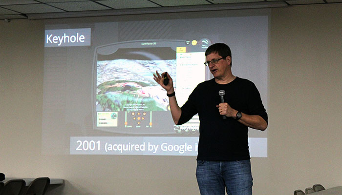
This technology is a far cry from what McClendon used on his mapping startup, Keyhole, in 2001.
McClendon had been working on graphic computers that were used in motion pictures. In the ’90s, graphics computers were huge, had low computing power and cost upwards of $250,000. Movie producers for films such as “Terminator 2,” “The Abyss” or “Jurassic Park” might use five to 10 minutes of computer-generated graphics in a movie because they were so costly. Today almost every second of a major motion picture has been augmented by computer-generated graphics.
Keyhole was a paid mapping service. It sprung to prominence when CNN bought into the service and used it repeatedly in the coverage of the Iraq War.
Google bought the company in 2004, and it was ultimately renamed Google Earth. Today, there have been more than 2 billion downloads from Google Earth.
In 2007, Street View was launched in five cities. A van, costing about $250,000, drove streets taking pictures of cityscapes. This first incarnation was inefficient and expensive, McClendon said. One person drove, and another person took notes on street names and sometimes took photos.
More efficient Street View equipment was developed until Google had 99 percent of the U.S. covered. This was combined with aerial views, GPS and other map data to create better maps.
Google was trying to use Street View photos to pinpoint exact addresses. However, the addresses in photos had to be confirmed by two human employees. This was time-consuming and costly. Google turned to the public for help. It used “Are you a robot?” questions to confirm data. Software would use a known image to confirm it was dealing with a human and then ask the person to confirm the numbers of an address in a photo.
Technology has now advanced beyond the need for human confirmation. Programmers can teach machines to recognize images in large data sets using machine learning. You can take a set of known images with numbers like the Google addresses and teach the computer to recognize images of numbers using this confirmed data.
McClendon said this type of technology could be used to replace radiologists. With 98 percent accuracy, a computer could be more accurate than two human radiologists in detecting cancer in X-rays
Even Google, however, can be wrong. In 2010, a mistake on Google Maps started a war. Nicaragua invaded Costa Rica over a misdrawn border on Google Maps. The incorrect map information had come from the U.S. State Department, and Google quickly corrected it. The Nicaraguans occupied a sandbar for a short time, but eventually pulled their troops out.
“It is not all about the maps and the data,” he said. “It is about the story we tell on top of the maps. We base maps on human nature, and it matters what is on top of them.”
In 2007, during the genocide in Darfur, humanitarians used Google Maps to show George W. Bush the burned-out homes and huts in a large area in Sudan, illustrating the genocide in the region was much more widespread than initially reported.
The information prompted the president to take action the next day in the region.

Today, interactive images of our world are being used in virtual reality to make games and virtual experiences more appealing. However, McClendon said he saw VR eventually moving into augmented reality. This use of technology would use a pair of glasses. Digital images would be superimposed over the image of the real world.
This application could be used for driving directions, to help city workers find water lines, help you find a nearby coffee shop or an apartment to rent.
McClendon encouraged students to consider computer technology in their studies, adding every profession can be enhanced by technology.
He gave the example of three Kansas startups that are reaching into the future today.
C2FO in Shawnee Mission is developing a system that would allow companies to process accounts receivables and payables between each other more quickly. The technology could save the business world $4 trillion.
EVOKE, which was developed at KU, created an electronic device that helps patients undergoing spinal fusions heal in three to six weeks instead of three to nine months.
Just Play Sports, also a company coming out of KU, developed a program to help football and basketball players learn plays faster through quizzes and videos created specifically for their positions. It is being used by KU basketball, two NBA teams and another 97 teams across the nation.