
NWS
DODGE CITY – URGENT – WINTER WEATHER MESSAGE
National Weather Service Dodge City KS
153 AM CST Sat Jan 20 2018
Trego-Ellis-Scott-Lane-Ness-Hamilton-Kearny-Finney-Including the cities of WaKeeney, Pfeifer, Hays, Scott City, Scott State Lake, Dighton, Ness City, Syracuse, Lakin, Deerfield, and Garden City
153 AM CST Sat Jan 20 2018 /1253 AM MST Sat Jan 20 2018/
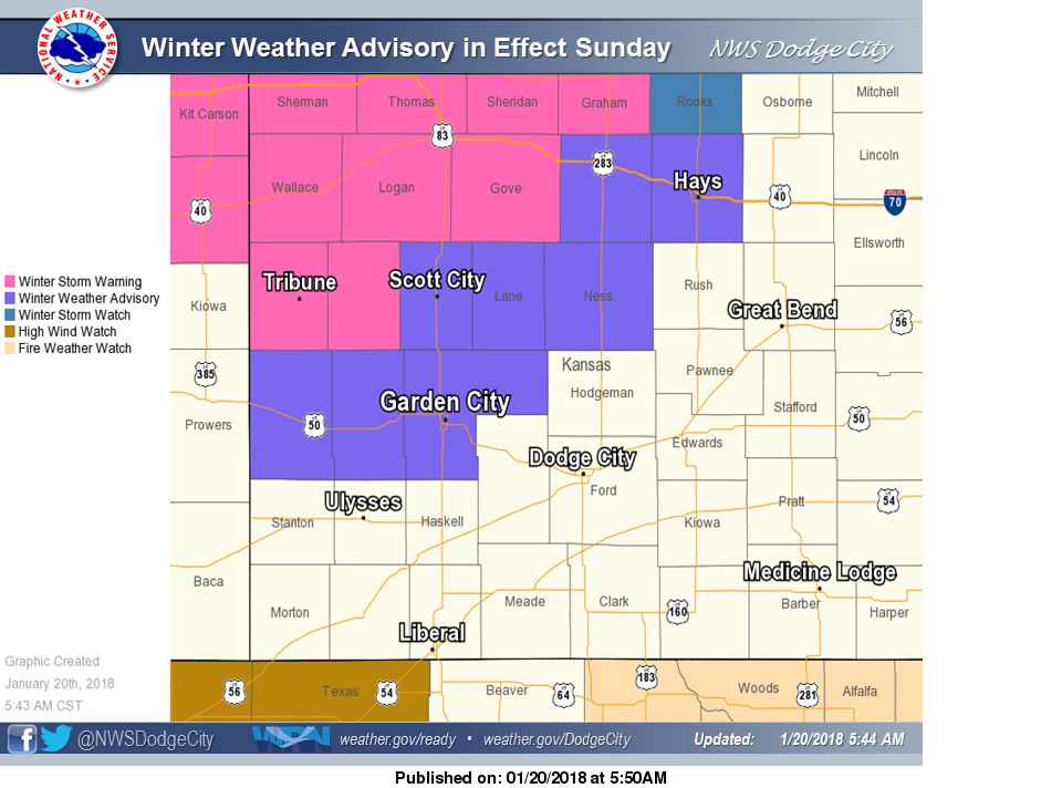
…WINTER WEATHER ADVISORY IN EFFECT FROM 6 AM CST /5 AM MST/ SUNDAY TO 6 AM CST /5 AM MST/ MONDAY…
The National Weather Service in Dodge City has issued a Winter Weather Advisory for snow and blowing snow, which is in effect from 6 AM CST /5 AM MST/ Sunday to 6 AM CST /5 AM MST/ Monday.
* TIMING…A light wintry mix will begin Sunday morning, with a rain and snow mix becoming more widespread Sunday afternoon. All
precipitation will quickly change to snow around sunset on Sunday. Light snow will continue Sunday night, accompanied by very strong NW winds. Snow and blowing snow will taper off Monday morning.
* MAIN IMPACT…Snow, along with blowing and drifting snow, will result in travel difficulties. Expect slick roads and reduced visibilities. Snow amounts of 1 to 3 inches are expected, along with significant drifting.
PRECAUTIONARY/PREPAREDNESS ACTIONS…
A Winter Weather Advisory means that periods of snow and blowing snow will cause travel difficulties. Be prepared for slippery roads and limited visibilities…and use caution while driving.