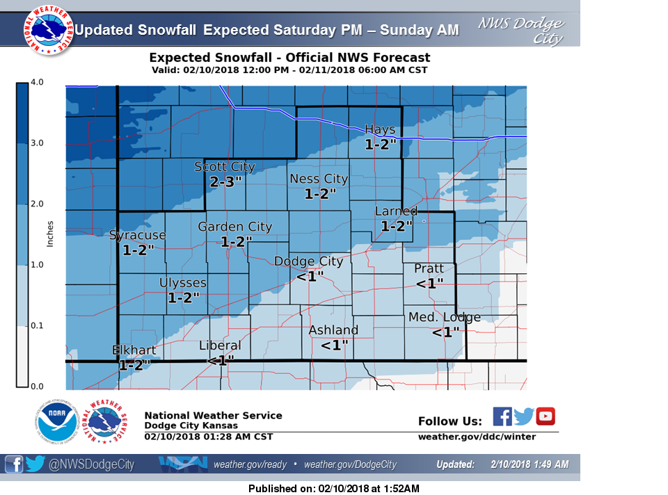
 A Winter weather advisory is in effect from 3PM this afternoon until 6AM Sunday morning. Snow accumulations of 2-3 inches can be expected. Snow covered roads and limited visibilities may cause travel difficulties, use caution while driving.
Today
Cloudy and cold with snow after 3pm. High near 15. Wind chill values as low as -10. North wind 11 to 14 mph. Chance of precipitation is 80%. Total daytime snow accumulation of less than one inch possible.
Tonight
Snow, mainly before 2am. Low around 6. Wind chill values as low as -5. North wind 7 to 11 mph becoming west after midnight. Chance of precipitation is 90%. New snow accumulation of 1 to 2 inches possible.
Sunday
Sunny, with a high near 38. Wind chill values as low as -5. West wind 6 to 8 mph.
Sunday Night
Mostly clear, with a low around 14. Wind chill values as low as 3. South wind 6 to 8 mph.
Monday
Mostly sunny, with a high near 40. Breezy, with a south southeast wind 8 to 13 mph increasing to 15 to 20 mph in the afternoon. Winds could gust as high as 30 mph.
Monday Night
Mostly cloudy, with a low around 21.
Tuesday
Partly sunny, with a high near 46.
Tuesday Night
Partly cloudy, with a low around 23.
Wednesday
Sunny, with a high near 61.