
By BECKY KISER
Hays Post
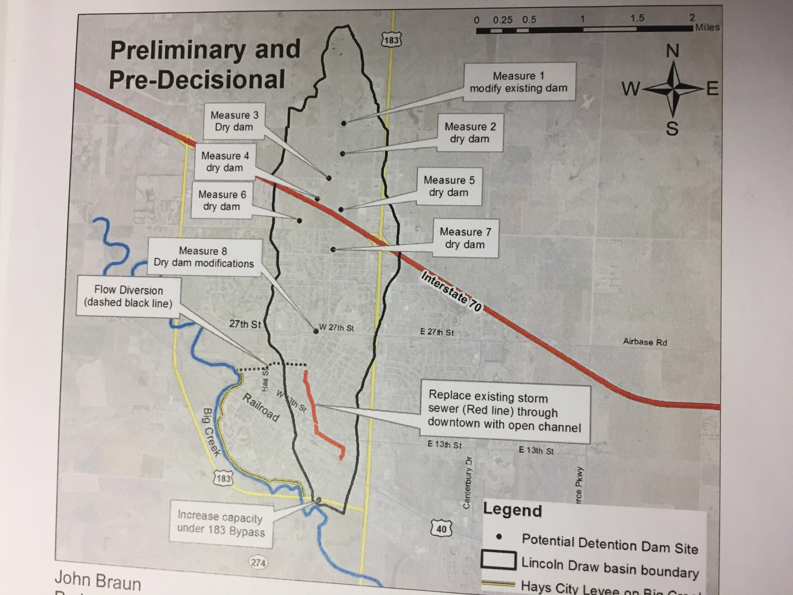
The U.S. Army Corps of Engineers is conducting a study with the goal of reducing the frequency and severity of flooding within the boundaries of the Lincoln Draw Watershed through the center of Hays.
According to Hays Project Manager John Braun, the watershed covers an area of 4.25 square miles and flows through the heart of the city before entering Big Creek at Montgomery Ditch.
“It starts about a half-mile north of 55th Street and cuts through the downtown area, the most developed area of the city,” Braun said. “Besides the actual flooding of Big Creek, a large rain event over the Lincoln Draw Watershed has the greatest potential for flood damages in the city of Hays.”
The Corps of Engineers will hold an informational meeting next week to present an update on the preliminary result of the ongoing study.
The study of Lincoln Draw Watershed has been underway for about 2.5 years.
“We’re looking at wrapping it up this year or early next year,” said Braun. “We’re calling this a mid-study report. The Corps of Engineers will provide their results so far and where they’re headed with this so there won’t be any surprises at the end.”
The city requested the study in 2015. “The Corps appropriated funding for the initial phase and then the city entered into a cost share agreement for the next phase of the study,” Braun explained.
The public is invited to attend the meeting at 5:30 p.m. Tue., March 20, at Hays City Hall, 1507 Main Street.
For more information, contact Braun at the Office of Project Management, 785-628-7350, or [email protected].