Monday Showers and possibly a thunderstorm. Some of the storms could produce heavy rain. Areas of fog before 8am. High near 65. South wind 8 to 14 mph. Chance of precipitation is 80%. New rainfall amounts between three quarters and one inch possible.
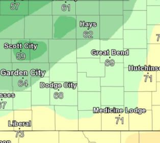
Scattered showers and thunderstorms are expected to continue through Tuesday night. #kswx #nwsddc pic.twitter.com/0nN41lg6wY
— NWS Dodge City (@NWSDodgeCity) October 8, 2018
Monday Night Showers likely and possibly a thunderstorm. Some of the storms could produce heavy rain. Cloudy, with a low around 49. South southeast wind 10 to 13 mph becoming northwest after midnight. Chance of precipitation is 70%. New rainfall amounts between a half and three quarters of an inch possible.
TuesdayShowers likely and possibly a thunderstorm. Some of the storms could produce heavy rain. Cloudy, with a high near 55. North northwest wind around 11 mph. Chance of precipitation is 70%. New precipitation amounts between a half and three quarters of an inch possible.
Tuesday NightShowers likely, mainly before 8pm. Mostly cloudy, with a low around 38. North wind around 11 mph. Chance of precipitation is 60%. New precipitation amounts of less than a tenth of an inch possible.
WednesdayMostly sunny, with a high near 56.
Wednesday NightMostly clear, with a low around 37.
ThursdayPartly sunny, with a high near 52.