Today Mostly cloudy, with a high near 42. Northeast wind 8 to 11 mph.
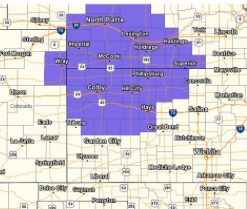
<blockquote class=”twitter-tweet” data-lang=”en”><p lang=”en” dir=”ltr”>A winter weather advisory is in effect for portions of western and northern KS late Wed. Night through Thurs. for 2-4 inches of snow. <a href=”https://twitter.com/hashtag/kswx?src=hash&ref_src=twsrc%5Etfw”>#kswx</a> <a href=”https://t.co/uyIAxJqc8m”>pic.twitter.com/uyIAxJqc8m</a></p>— NWS Dodge City (@NWSDodgeCity) <a href=”https://twitter.com/NWSDodgeCity/status/1059942619973869568?ref_src=twsrc%5Etfw”>November 6, 2018</a></blockquote> <script async src=”https://platform.twitter.com/widgets.js” charset=”utf-8″></script>
Tonight A slight chance of rain before 11pm, then rain and snow likely between 11pm and 1am, then snow after 1am. Low around 29. East northeast wind 7 to 10 mph. Chance of precipitation is 80%. New snow accumulation of around an inch possible.
The updated snowfall forecast for late Wednesday Night into Thursday calls for 1 to 4 inches across much of western KS #kswx pic.twitter.com/4M2i2psOYc
— NWS Dodge City (@NWSDodgeCity) November 6, 2018
Thursday Snow before 3pm, then rain and snow likely between 3pm and 5pm, then snow likely after 5pm. High near 35. East wind 6 to 9 mph. Chance of precipitation is 80%. New snow accumulation of 1 to 3 inches possible.
Thursday Night Mostly cloudy, with a low around 25. North northeast wind 5 to 7 mph becoming west after midnight.
FridaySunny, with a high near 34.
Friday NightClear, with a low around 19.
SaturdaySunny, with a high near 47.