 NWS
NWS
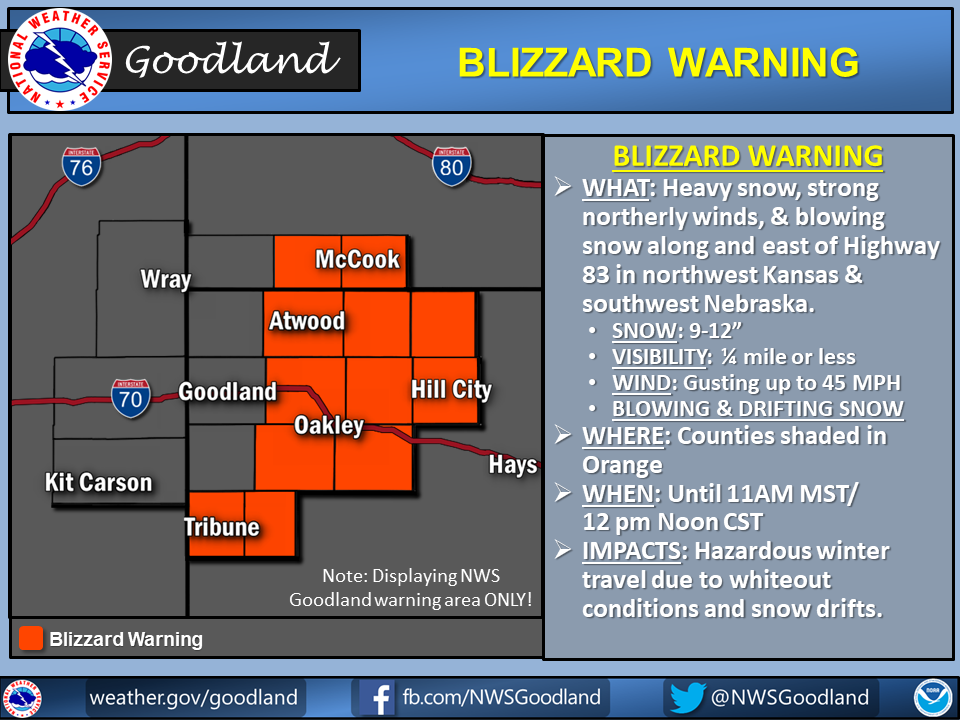
GOODLAND – A Blizzard Warning is in effect until 11 a.m. MST/12 p.m. CST for Rawlins, Decatur, Norton, Thomas, Sheridan, Graham, Logan, Gove, Greeley, and Wichita counties in NW Kansas.
* WHAT…Heavy snow, strong northerly winds, and blowing snow.
Snow accumulations will range from as little as 1-3 inches in
eastern Colorado to as much as 9-12 inches along and east of
Highway 83 in northwest Kansas and southwest Nebraska.
* ADDITIONAL DETAILS…Travel will become extremely dangerous or
impossible late tonight and Thursday. Blizzard conditions will
be possible Thursday morning, particularly along and east of
Highway 83 in northwest Kansas and southwest Nebraska.
* WINDS/VISIBILITY…Winds gusting 40 to 45 mph with visibility
down to one quarter mile or less creating whiteout conditions.
* SNOW ACCUMULATIONS…As much as 9 to 12 inches in northwest
Kansas and southwest Nebraska.
* MAIN IMPACT…Hazardous winter travel due to whiteout
conditions and snow drifts.
* OTHER IMPACTS…Heavy wet snow and strong winds will create
dangerous travel conditions. Expect snowpacked roadways,
reduced visibility, and blowing and/or drifting snow.
PRECAUTIONARY/PREPAREDNESS ACTIONS…
A Winter Storm Warning for snow means severe winter weather
conditions will make travel extremely hazardous or impossible. If
you must travel, keep an extra flashlight, food and water in your
vehicle in case of an emergency.
The latest road conditions for the state you are calling from can
be obtained by calling 5 1 1.
A Blizzard Warning means strong winds and falling or blowing snow
will produce whiteout conditions at times…with travel becoming
difficult or impossible. Monitor local forecasts before deciding
to venture outside. If you must travel and you become stranded…
stay with your vehicle until help arrives.