 The National Weather Service in Dodge City has issued a hazardous weather outlook for the remainder of Friday and overnight Saturday.
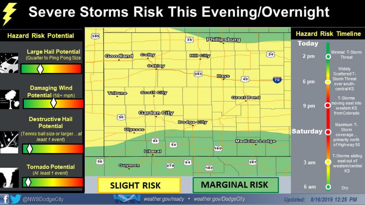
Forecasters are predicting isolated strong to severe thunderstorms possible after 4 p.m. south and east of Dodge City. The storms could bring quarter-size hail, wind gusts of up to 60 mph and heavy rainfall.
After 7 p.m., the chance for additional storms return, this time north of a line from Garden City to Rush Center. Wind up to 60 mph, heavy rain and large hail also could accompany these storms.
The chance of rain Friday night and overnight in Hays is about 70 percent. Skies are expected to begin to clear after 7 a.m. Saturday.
Click HERE for current weather conditions.