 A hot, sunny day is in store today with high temperatures near 103. Winds will be light in the morning, becoming southerly at around 10 mph.
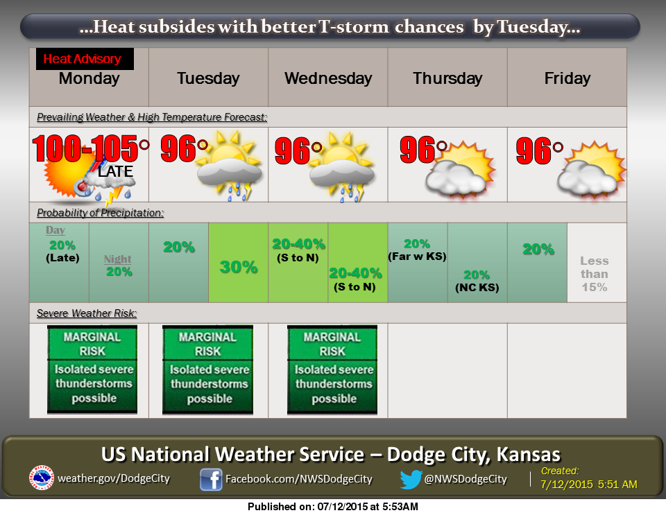
A heat advisory is in effect through Monday. If outdoor activities are planned, please keep up to date with the latest forecast and take precations to avoid heat stress.
Slightly cooler weather can be expected by Tuesday, along with a chance for thunderstorms each day this week.
**A Heat Advisory is in effect from 2pm this afternoon to 7pm Monday for Ellis County due to the combination of hot temperatures and high humidity**
-Here’s Mike Cooper with tips to avoid heat stress:
Today: Sunny and hot, with a high near 103. Heat index values as high as 106. South wind 6 to 10 mph.
Tonight: Partly cloudy, with a low around 75. Southwest wind 7 to 10 mph.
Monday: A 20 percent chance of showers and thunderstorms after 3pm. Mostly sunny and hot, with a high near 104. West wind 8 to 10 mph becoming northeast in the afternoon.
Monday Night: A 30 percent chance of showers and thunderstorms, mainly before 9pm. Mostly cloudy, with a low around 71. Northeast wind 7 to 10 mph.
Tuesday: A 20 percent chance of showers and thunderstorms after 3pm. Mostly sunny, with a high near 97. Northeast wind 8 to 11 mph becoming east southeast in the afternoon.