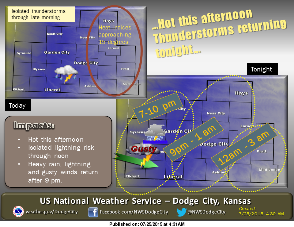
 Isolated morning showers will likely end before 10am. By afternoon, heat indices will reach the 100 to 105 range with hottest values across central Kansas. Thunderstorms will develop over eastern Colorado later tonight and spread into the lower plains overnight. Some uncertainty exists as to how far north the development will be as some models maintain most of the activity across west central into central Kansas, while others favor southwest Kansas early in the evening, and then driving most of the storms into the panhandles. So the greatest chances for strong winds, heavy rain and small hail will be over the southwest counties mid evening, with chances farther east, later in the night.
Today’s high will be near 100 with an overnight low around 73. Temperatures will be near 100 each day Sunday through Tuesday, with additional chances for scattered thunderstorms. A cool front will cross the region Tuesday night. Temperatures will turn slightly cooler for Wednesday and Thursday.
Today: A chance of showers and thunderstorms before 10am, then a slight chance of showers and thunderstorms after 1pm. Partly sunny, with a high near 99. East southeast wind 8 to 17 mph becoming south in the afternoon. Chance of precipitation is 30%.
Tonight: A 40 percent chance of showers and thunderstorms, mainly before midnight. Mostly cloudy, with a low around 73. South southeast wind 6 to 11 mph.
Sunday: A 20 percent chance of showers and thunderstorms after 4pm. Mostly sunny and hot, with a high near 100. South southeast wind 5 to 13 mph.
Sunday Night: A 40 percent chance of showers and thunderstorms, mainly after 8pm. Mostly cloudy, with a low around 74. South southeast wind 8 to 14 mph.
Monday: A 10 percent chance of showers and thunderstorms before 7am. Mostly sunny and hot, with a high near 103. Breezy, with a south wind 9 to 14 mph increasing to 17 to 22 mph in the afternoon.