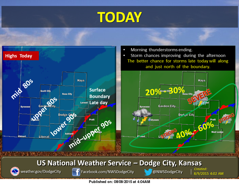
 A stationary front will be located across south central Kansas today. West of this boundary highs today will range from the mid 80s to lower 90s. A Canadian cool front will pass through the area tonight. Ahead of the front, there is a chance of showers and thunderstorms mainly along and south of Interstate 70.
Temperatures will be below normal Monday through Wednesday, but still very pleasant, with a slow warming trend and plenty of sunshine.
We recieved .70 of an inch of rain in the last 24 hours at the Eagle Media Center.
Today: A 30 percent chance of showers and thunderstorms, mainly after 3pm. Partly sunny, with a high near 90. West wind 6 to 8 mph becoming east in the afternoon.
Tonight: A 30 percent chance of showers and thunderstorms, mainly before 11pm. Mostly cloudy, with a low around 69. South southeast wind 5 to 8 mph becoming light and variable.
Monday: Mostly sunny, with a high near 87. North wind 7 to 17 mph.
Monday Night: Partly cloudy, with a low around 65. North northeast wind 5 to 13 mph.
Tuesday: Partly sunny, with a high near 86. Light and variable wind becoming east northeast 5 to 8 mph in the afternoon.