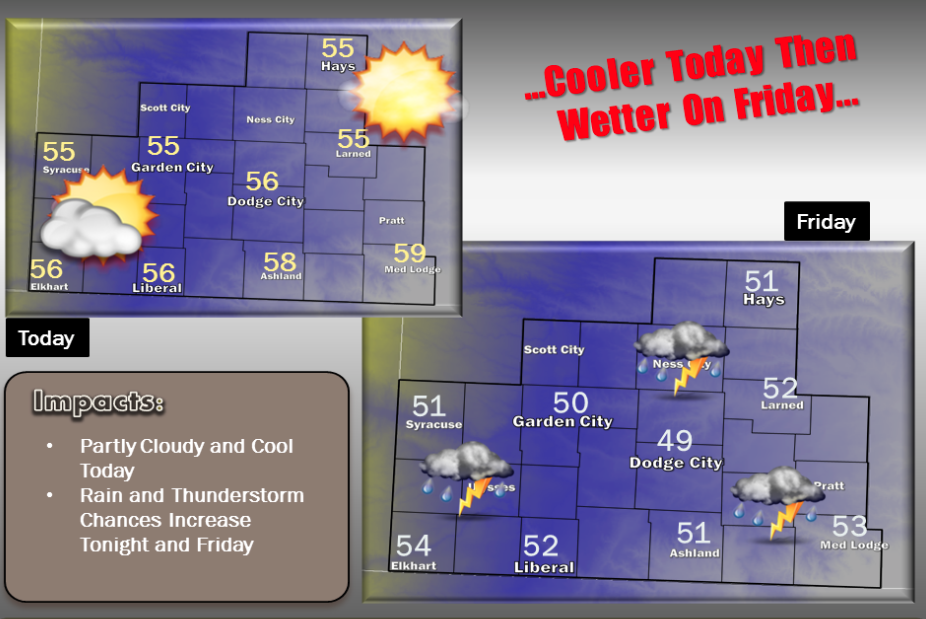
A cold front moving through southwest Kansas will bring cooler temperatures to the area today. Highs will be topping out in the mid to upper 50s. A storm system moving out east out of the Rockies will bring increasing chances for rain and a few thunderstorms to the area starting late tonight and continuing through Friday before ending Friday night.
Today Mostly sunny, with a high near 55. North wind 3 to 8 mph.
Tonight A slight chance of showers between 3am and 4am, then a slight chance of showers and thunderstorms after 4am. Mostly cloudy, with a low around 39. Southeast wind around 8 mph. Chance of precipitation is 20%.
 Friday A chance of showers and thunderstorms before 10am, then showers likely and possibly a thunderstorm between 10am and 1pm, then showers likely after 1pm. Cloudy, with a high near 51. South southeast wind 8 to 13 mph. Chance of precipitation is 70%. New rainfall amounts between a quarter and half of an inch possible.
Friday NightShowers likely, mainly before 10pm. Cloudy, with a low around 41. East wind 6 to 9 mph becoming northwest after midnight. Chance of precipitation is 60%. New precipitation amounts between a tenth and quarter of an inch possible.
SaturdayMostly sunny, with a high near 66.
Saturday NightClear, with a low around 41.
SundaySunny, with a high near 73.
Sunday NightClear, with a low around 44.