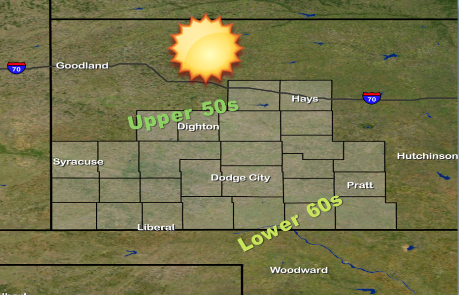
Breezy westerly winds will continue today. Clouds will quickly clear from west to east early this morning, allowing temperatures to warm into the upper 50s and low 60s. Highs could be slightly cooler in the extreme west central sections of the area, mainly west and northwest of the Syracuse area where several inches of snow fell yesterday. Another weather system will dive through the northern High Plains bringing another round of rain and now mainly across Nebraska later today. Pacific high pressure will overspread the area on Thursday, and bring slightly cooler high temperatures in the low 50s. The rest of the week looks mainly dry and seasonal temperature-wise for southwest and central Kansas.
 Today Partly sunny, with a high near 55. Breezy, with a west wind 13 to 21 mph.
Tonight Mostly clear, with a low around 24. North northwest wind 8 to 16 mph.
ThursdayMostly sunny, with a high near 51. West wind 7 to 11 mph.
Thursday NightPartly cloudy, with a low around 29. South southwest wind 5 to 9 mph.
FridayPartly sunny, with a high near 48.
Friday NightA slight chance of rain and snow before 7pm, then a slight chance of snow. Partly cloudy, with a low around 24. Chance of precipitation is 20%.
SaturdayA 20 percent chance of snow before 7am. Sunny, with a high near 40.
Saturday NightPartly cloudy, with a low around 25.
SundaySunny, with a high near 47.