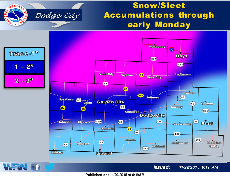
 Cloudy and cold today with temperatures rising to around 32 degrees before falling back into the mid to upper 20s tonight. Sleet is expected to develop this evening then changing to snow and continuing into Monday morning. The highest accumulations are expected over parts of central and west central Kansas with 1 to 3 inches of accumulation. Some freezing drizzle is also expected with the snow.
Today: Patchy freezing drizzle before noon, then a chance of snow and sleet between noon and 5pm, then areas of snow, freezing drizzle, and sleet after 5pm. Cloudy, with a high near 30. Calm wind becoming east 5 to 7 mph in the afternoon. Chance of precipitation is 40%.
Tonight: Areas of snow, freezing drizzle, and sleet before 7pm, then snow, possibly mixed with freezing drizzle. Low around 25. East northeast wind around 7 mph. Chance of precipitation is 90%. Little or no ice accumulation expected. New snow and sleet accumulation of 1 to 3 inches possible.
Monday: Snow likely, mainly before 11am. Mostly cloudy, with a high near 33. East wind 7 to 17 mph becoming northwest in the afternoon. Chance of precipitation is 70%. New snow accumulation of less than one inch possible.
Monday Night: Partly cloudy, with a low around 19. West wind 10 to 15 mph.
Tuesday: Sunny, with a high near 38. West northwest wind 11 to 16 mph.