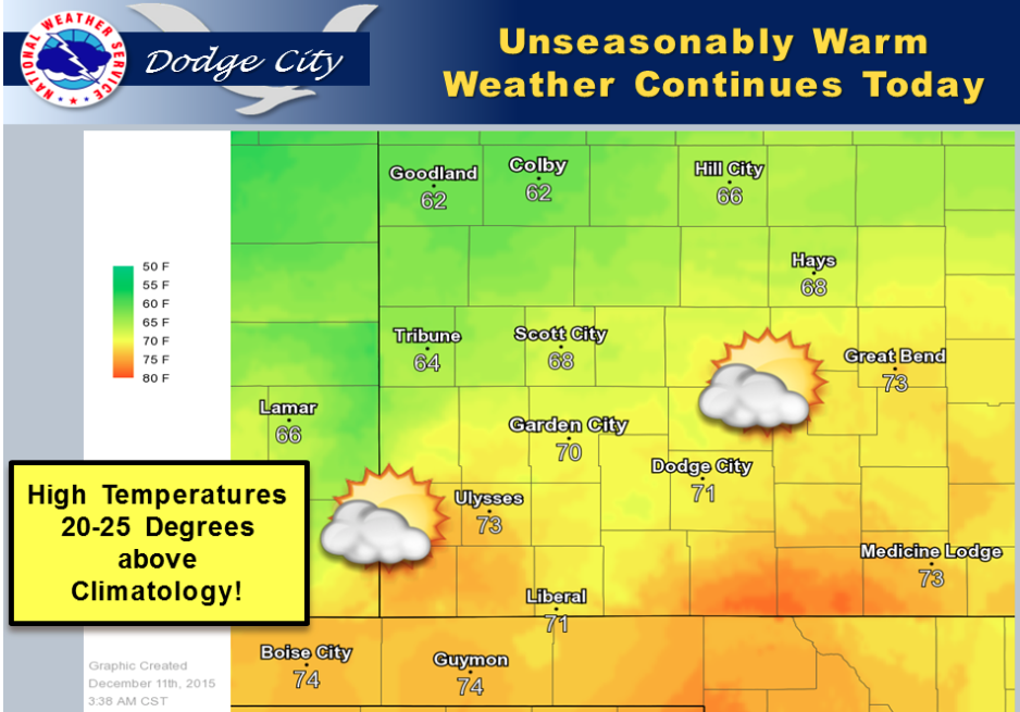
Unseasonable warmth will continue today with highs from the mid 60s to the lower 70s. A weak cold front will move into northern Kansas this afternoon, but little cooling will occur behind the front today. Increasingly cool air will spread south on Saturday and sharpen the temperature gradient along the front. High level moisture from the Pacific in advance of a powerful upper level storm system will result in partly cloudy skies.
 Today Partly sunny, with a high near 68. Southwest wind 7 to 10 mph becoming north in the afternoon.
Tonight Mostly cloudy, with a low around 38. Northeast wind 8 to 11 mph.
SaturdayA 30 percent chance of rain, mainly after 3pm. Cloudy, with a high near 46. Northeast wind 11 to 14 mph.
Saturday NightA chance of rain before 5am, then a chance of rain and snow. Cloudy, with a low around 32. Breezy, with a north wind 14 to 20 mph. Chance of precipitation is 50%. Little or no snow accumulation expected.
SundaySnow likely, possibly mixed with rain, mainly between 9am and 11am. Mostly cloudy, with a high near 37. Breezy, with a north northwest wind 15 to 22 mph. Chance of precipitation is 60%. New precipitation amounts between a tenth and quarter of an inch possible.
Sunday NightA slight chance of freezing rain before 7pm, then a slight chance of snow. Partly cloudy, with a low around 27. Chance of precipitation is 20%.
MondaySunny, with a high near 47.