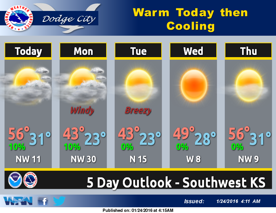
 A warm front will lift into Kansas today with mild temperatures. An upper level disturbance will then bring a cold front across the Central Plains tonight into Monday with strong winds. There is a slight chance of rain and snow late Sunday night into Monday morning.
The rest of the week will see a warming trend as snow melts, with highs in the 40s and then in the 50s by the end of the week.
Today: Areas of freezing fog before 9am. Partly sunny, with a high near 46. Light and variable wind becoming south southeast 5 to 8 mph in the morning.
Tonight: A slight chance of rain and snow between 9pm and 11pm, then a slight chance of snow after 11pm. Mostly cloudy, with a low around 27. East northeast wind 7 to 17 mph becoming north northwest after midnight. Chance of precipitation is 20%.
Monday: A 20 percent chance of snow before 8am. Mostly cloudy, with a high near 40. Windy, with a north northwest wind 20 to 26 mph, with gusts as high as 36 mph.
Monday Night: Partly cloudy, with a low around 22. Blustery, with a northwest wind 15 to 20 mph decreasing to 9 to 14 mph after midnight.
Tuesday: Sunny, with a high near 41. Northwest wind 10 to 15 mph.