NWS
WINTER STORM UPDATE
The newest winter storm model runs this morning are in from the National Weather Service in Dodge City, and they continue to support our going forecast. This is important, because the center of the storm is near Flagstaff, Arizona this morning, and its jet stream structure has been sampled by our weather balloons. This gives us confidence that the forecast track will hold.
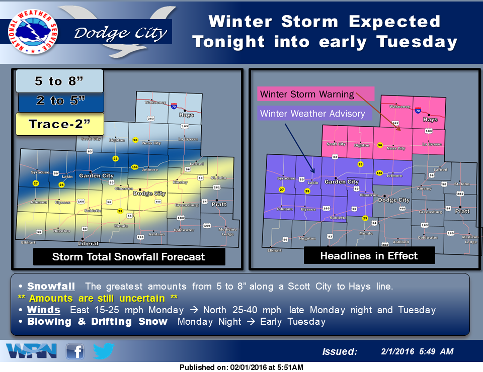
The center of this strong storm will pass directly over Dodge City tonight, but the heaviest snow will fall well north of the center, near the I-70 corridor tonight and Tuesday AM.
Our far northern areas from Scott City to Hays can expect 5-6 inches of snow, while Dodge City will get by with an inch or less.
If travelling north tonight into Tuesday morning, be aware that travel conditions will worsen the further north you travel from Dodge City. Tuesday will be very windy and cold. It is still winter.
