 After an extended period of dry weather, we are expecting beneficial rain to spread from west to east across the region over the weekend.
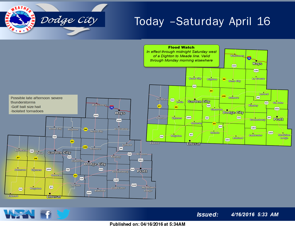
There is another chance late this afternoon for severe thunderstorms. Rainfall of 2 to 3 inches over the southwestern counties last night and early this morning will accentuate any additional rainfall that may occur later today and tonight. A higher risk of flash flooding will be present with any heavy rainfall that may occur. A Flood Warning ins in effect for areas west of a Dighton to Meade line through midnight. A Flood Watch remains in effect for the remaining area east of this line through Monday morning.
Today: Showers and thunderstorms. Some of the storms could produce heavy rain. High near 65. Breezy, with a southeast wind 18 to 23 mph. Chance of precipitation is 90%. New rainfall amounts between a quarter and half of an inch possible.
Tonight: Showers and thunderstorms. Some of the storms could produce heavy rain. Low around 52. Breezy, with a southeast wind 15 to 23 mph. Chance of precipitation is 90%. New rainfall amounts between three quarters and one inch possible.
Sunday: Showers and thunderstorms. Some of the storms could produce heavy rain. High near 60. East southeast wind 14 to 18 mph. Chance of precipitation is 100%. New rainfall amounts between three quarters and one inch possible.
Sunday Night: Showers and thunderstorms. Some of the storms could produce heavy rain. Low around 44. Northwest wind 13 to 15 mph. Chance of precipitation is 90%. New rainfall amounts between a half and three quarters of an inch possible.
Monday: A 50 percent chance of showers. Mostly cloudy, with a high near 63. Northwest wind 13 to 16 mph.