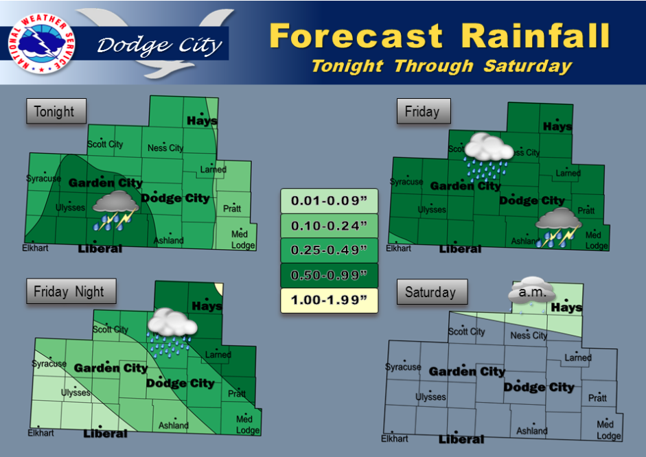
Today Showers and thunderstorms before 10am, then showers and possibly a thunderstorm after 10am. High near 48. Breezy, with a northeast wind 14 to 22 mph. Chance of precipitation is 90%. New rainfall amounts between three quarters and one inch possible.
Tonight Showers. Low around 38. Northeast wind 13 to 16 mph becoming northwest after midnight. Chance of precipitation is 90%. New precipitation amounts between three quarters and one inch possible.
SaturdayA 30 percent chance of showers, mainly before 4pm. Mostly cloudy, with a high near 58. West northwest wind 14 to 18 mph, with gusts as high as 28 mph.
Saturday NightA 20 percent chance of showers. Mostly cloudy, with a low around 40. North northwest wind 14 to 17 mph.
SundayMostly cloudy, with a high near 54.
Sunday NightA 20 percent chance of showers. Mostly cloudy, with a low around 39.
MondayA 20 percent chance of showers. Mostly cloudy, with a high near 59.
Monday NightMostly cloudy, with a low around 40.