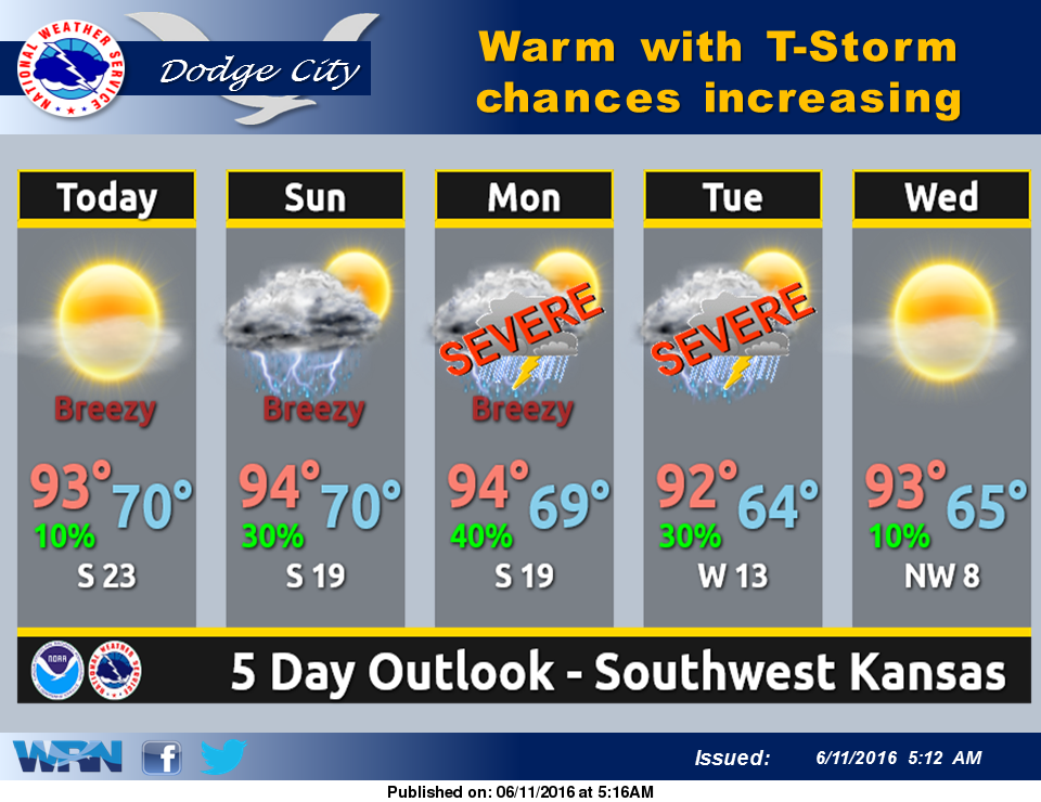
 This weekend, a continued blast of early summer heat is in store, with very little chance of thunderstorm activity until late Sunday afternoon. High temperatures both today and Sunday will soar into the mid 90s, with afternoon heat index values averaging in the 95 to 100 range.
Thunderstorm chances make a return, late Sunday afternoon with scattered activity expected to affect much of the area Sunday evening into Sunday night. Off-and-on thunderstorm chances will continue through late Tuesday night. Dry and hot conditions return the rest of the week.
Today: Sunny, with a high near 95. South wind 6 to 11 mph increasing to 12 to 17 mph in the afternoon. Winds could gust as high as 29 mph.
Tonight: Mostly clear, with a low around 70. South southeast wind 8 to 16 mph.
Sunday: A 20 percent chance of showers and thunderstorms after 4pm. Sunny, with a high near 93. South wind 8 to 15 mph.
Sunday Night: Showers and thunderstorms likely, mainly between midnight and 2am. Mostly cloudy, with a low around 70. Southeast wind 6 to 13 mph. Chance of precipitation is 60%. New rainfall amounts between a quarter and half of an inch possible.
Monday: A 40 percent chance of showers and thunderstorms. Partly sunny, with a high near 90. East southeast wind 6 to 13 mph.