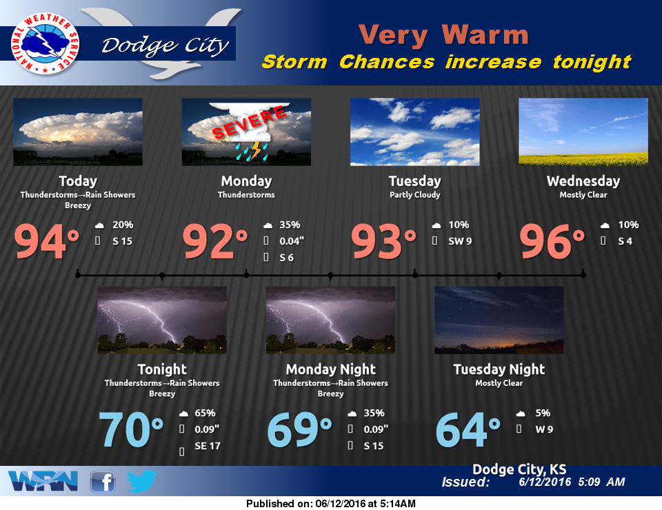
 Hot and dry today, with high temperatures reaching the low-to-mid 90s. By late this afternoon into tonight, thunderstorm activity that will initially develop to the north and west along an approaching cold front will gradually start working its way across Kansas. Some of the storms may contain heavy rainfall and small hail.
An unsettled weather pattern will continue into Monday and Tuesday, with additional chances for thunderstorms, some possibly severe as a warm front lifts north.
Today: A 30 percent chance of showers and thunderstorms, mainly after 4pm. Sunny, with a high near 94. South southeast wind 7 to 15 mph.
Tonight: A 50 percent chance of showers and thunderstorms. Mostly cloudy, with a low around 69. South southeast wind 6 to 14 mph.
Monday: A 40 percent chance of showers and thunderstorms. Partly sunny, with a high near 90. Southeast wind 7 to 10 mph.
Monday Night: A 50 percent chance of showers and thunderstorms. Mostly cloudy, with a low around 68. Southeast wind 9 to 13 mph.
Tuesday: A 40 percent chance of showers and thunderstorms, mainly before 2pm. Partly sunny, with a high near 88. Southeast wind 8 to 13 mph becoming west in the afternoon.