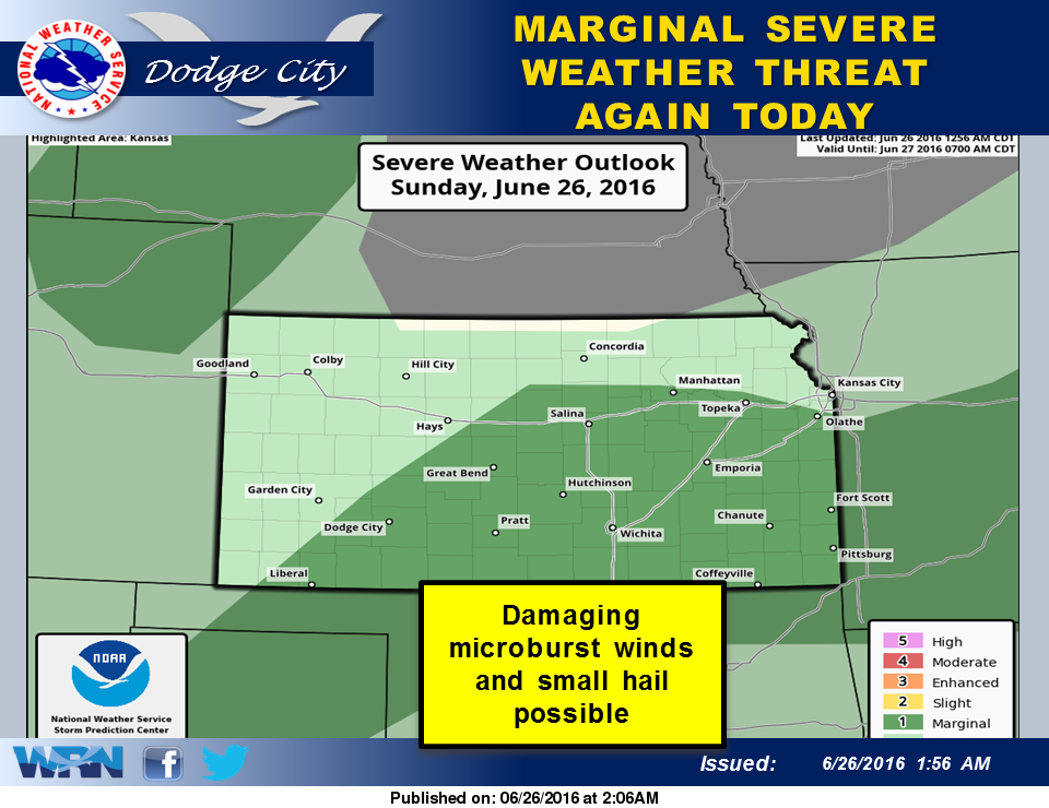
 A weak cold front will extend from eastern Kansas into the northern Texas Panhandle this afternoon. Moist and unstable air will continue across much of Kansas behind the front, and an upper level trough will support thunderstorm development again in the afternoon, especially from south central into southeast Kansas. The primary threat will be damaging microburst winds, although small hail is possible. Locally heavy rainfall may occur.
The weather pattern will change this week, resulting in cooler temperatures and increasing chances for rain. A series of cool fronts will drop south out of Canada, with cool high pressure behind each one. These fronts will become stationary across Kansas. Ingredients will be in place along these fronts for a chance of thunderstorms each day.
Today: A 30 percent chance of showers and thunderstorms, mainly after 1pm. Partly sunny, with a high near 85. Calm wind becoming east 5 to 9 mph in the morning.
Tonight: A 20 percent chance of showers and thunderstorms before 1am. Partly cloudy, with a low around 66. East southeast wind 5 to 10 mph becoming light east after midnight.
Monday: A 20 percent chance of showers and thunderstorms after 4pm. Mostly sunny, with a high near 91. East wind 5 to 10 mph.
Monday Night: A 40 percent chance of showers and thunderstorms, mainly after 7pm. Mostly cloudy, with a low around 66. East wind 5 to 10 mph.
Tuesday: A slight chance of showers and thunderstorms before 11am, then a slight chance of showers and thunderstorms after 3pm. Mostly sunny, with a high near 87. East northeast wind 6 to 11 mph. Chance of precipitation is 20%.