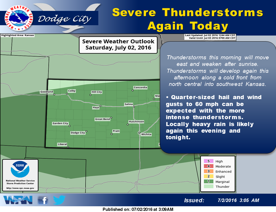
 Thunderstorms with heavy rain this morning gradually will weaken and move east. A weak cold front will move into northwest Kansas this morning and should extend from north central into southwest Kansas this afternoon. Thunderstorms are expected to develop along the front and grow into another large convective complex this evening.
Looking ahead to Sunday and Monday, outside of some lingering rain chances Sunday morning, the forecast is currently dry. Cloud cover is expected to gradually diminish with time, and winds will switch to the south. High temperatures are forecast to reach the mid 70s on Sunday and the mid to upper 80s for Monday.
Today: Showers and possibly a thunderstorm before 9am, then showers and thunderstorms likely, mainly after 4pm. High near 82. South southeast wind 8 to 11 mph becoming east in the afternoon. Chance of precipitation is 80%. New rainfall amounts between a quarter and half of an inch possible.
Tonight: Showers and thunderstorms likely, mainly before 9pm. Cloudy, with a low around 61. North wind 9 to 14 mph. Chance of precipitation is 70%. New rainfall amounts between a half and three quarters of an inch possible.
Sunday: A 10 percent chance of showers and thunderstorms before 7am. Mostly cloudy, with a high near 78. North wind 9 to 13 mph.
Sunday Night: Partly cloudy, with a low around 61. Northeast wind 5 to 9 mph becoming southeast after midnight.
Independence Day: Sunny, with a high near 87. Light south southeast wind becoming south 6 to 11 mph in the morning.