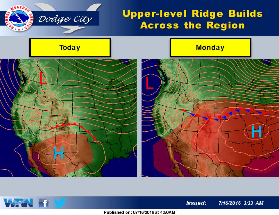
 The upper level and surface patterns will change starting today. An upper level ridge of high pressure over southern New Mexico today is expected to build into the central plains and Midwest by Monday. A warm front will develop over the southern plains today and then become stationary to the north of Kansas by Monday. High temperatures will warm into the 90’s today and upper 90’s by Sunday and then remain hot through next week. A few places will likely reach or exceed 100 degrees by Thursday and Friday.
In dry summers, this type of upper level pattern would result in temperatures well over 100 degrees. But due to the previous rains this spring and summer and lush vegetation, extremely hot readings of 105 degrees or higher are not expected through Friday. There are very small chances for thunderstorms over central and west central Kansas on Sunday along the warm front. Any thunderstorms Monday will probably stay north of Interstate 70 closer to the frontal boundary.
Today: Mostly sunny, with a high near 91. Breezy, with an east northeast wind 5 to 10 mph becoming south 17 to 22 mph in the morning.
Tonight: Partly cloudy, with a low around 73. Breezy, with a south wind 13 to 22 mph.
Sunday: Sunny, with a high near 99. South wind 9 to 16 mph becoming northwest in the afternoon.
Sunday Night: A 20 percent chance of showers and thunderstorms. Partly cloudy, with a low around 71. South southeast wind 8 to 14 mph becoming northeast after midnight.
Monday: A 20 percent chance of showers and thunderstorms. Mostly sunny, with a high near 97. Southeast wind 8 to 11 mph.