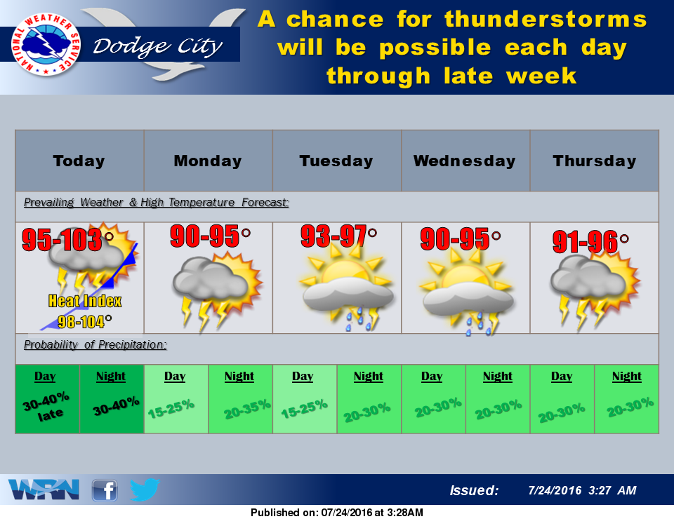
 Over the next five days there will be a chance for thunderstorms each day. More seasonal temperatures are also expected to return to western Kansas. A frontal boundary will bring slightly cooler conditions today with highs in the 90’s.
Looking ahead to Monday and Tuesday, chances for thunderstorms continue, with the best chances expected Tuesday night. Otherwise, high temperatures remain around 90.
Today: A slight chance of showers and thunderstorms before 10am, then a slight chance of showers and thunderstorms after 3pm. Partly sunny, with a high near 95. Northwest wind 7 to 14 mph becoming east in the afternoon. Winds could gust as high as 26 mph. Chance of precipitation is 20%.
Tonight: A 20 percent chance of showers and thunderstorms. Mostly cloudy, with a low around 70. East northeast wind 8 to 13 mph.
Monday: A 30 percent chance of showers and thunderstorms, mainly after 9am. Partly sunny, with a high near 90. East southeast wind 8 to 11 mph.
Monday Night: A 20 percent chance of showers and thunderstorms. Partly cloudy, with a low around 70. East southeast wind 6 to 11 mph.
Tuesday: A 20 percent chance of showers and thunderstorms. Mostly sunny, with a high near 93. South southeast wind 6 to 11 mph.